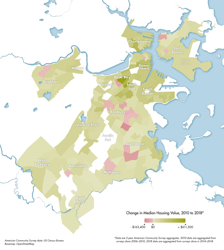
Change in median housing value, 2010 to 2018
Item Information
- Title:
- Change in median housing value, 2010 to 2018
- Description:
-
Daniel Huffman was contracted by the Leventhal Map & Education Center to create a series of maps using Boston-focused data for the purpose of in-class learning activities within the context of the LMEC's K-12 Maptivist Initiative. Daniel created maps for four distinctive topics: rent, gentrification, access to internet, and transportation, designed to meet the learning objectives set forth by education staff at the LMEC. These maps were created with strong points of view to challenge students to think critically about how data can be interpreted.
- Cartographer:
- Huffman, Daniel P.
- Copyright holder:
- Boston Public Library. Norman B. Leventhal Map and Education Center
- Date:
-
[2020]
- Format:
-
Maps/Atlases
- Location:
-
Boston Public Library
Norman B. Leventhal Map & Education Center - Collection (local):
-
Norman B. Leventhal Map & Education Center Collection
- Subjects:
-
Internet access--Massachusetts--Boston--Maps
Boston (Mass.)--Maps
- Places:
-
MassachusettsSuffolk (county)Boston
- Extent:
- 1 map : color
- Terms of Use:
-
(c) Norman B. Leventhal Map & Education Center at the Boston Public Library
This work is licensed for use under a Creative Commons Attribution Non-Commercial License (CC BY-NC).

- Language:
-
English
- Notes:
-
"American Community Survey data: US Census Bureau."
"Basemap: OpenStreetMap."
- Notes (date):
-
This date is inferred.
- Identifier:
-
HousingValueChange-2020


