Search Constraints
Search Results


1309. Bradford, Massachusetts


1315. Brasilia

1316. Brattleboro, Vt : 1876

1317. Brattleboro, Vt : 1886


1319. Brazil, Bolivia, & Peru


1321. Bressia = vulgo Bresse


1323. Breton Sound


1331. Bristol, Vt


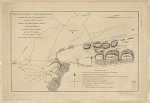
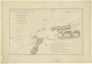
![British camp at Trudruffrin from [sic]](https://bpldcassets.blob.core.windows.net/derivatives/images/commonwealth:q524nb58k/image_thumbnail_300.jpg)


1345. British Columbia


1357. British Isles

1358. British Isles


1369. Brockton, Mass : 1878

1370. Brodhead, Wis : 1871


1372. Brookfield


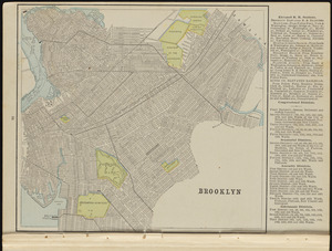
1375. Brooklyn
![Brown Bag Filling Machine Co., Inc., Fitchburg, Mass. [insurance map]](https://bpldcassets.blob.core.windows.net/derivatives/images/commonwealth:ww72bx549/image_thumbnail_300.jpg)


1379. Buctouche, New Brunswick

1380. Buenos Aires
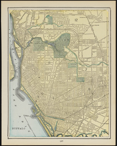
1381. Buffalo

1382. Buffalo County, Wis.


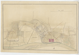
![[Bunker Hill--rough sketch]](https://bpldcassets.blob.core.windows.net/derivatives/images/commonwealth:z603vj151/image_thumbnail_300.jpg)


1391. Burmah

1392. Burnett County, Wis.


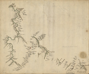
1395. Buzzards Bay

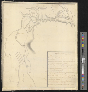
![[Buzzards Bay and Vineyard Sound]](https://bpldcassets.blob.core.windows.net/derivatives/images/commonwealth:7h149w47r/image_thumbnail_300.jpg)
![[Buzzards Bay and Vineyard Sound]](https://bpldcassets.blob.core.windows.net/derivatives/images/commonwealth:7h149z564/image_thumbnail_300.jpg)

