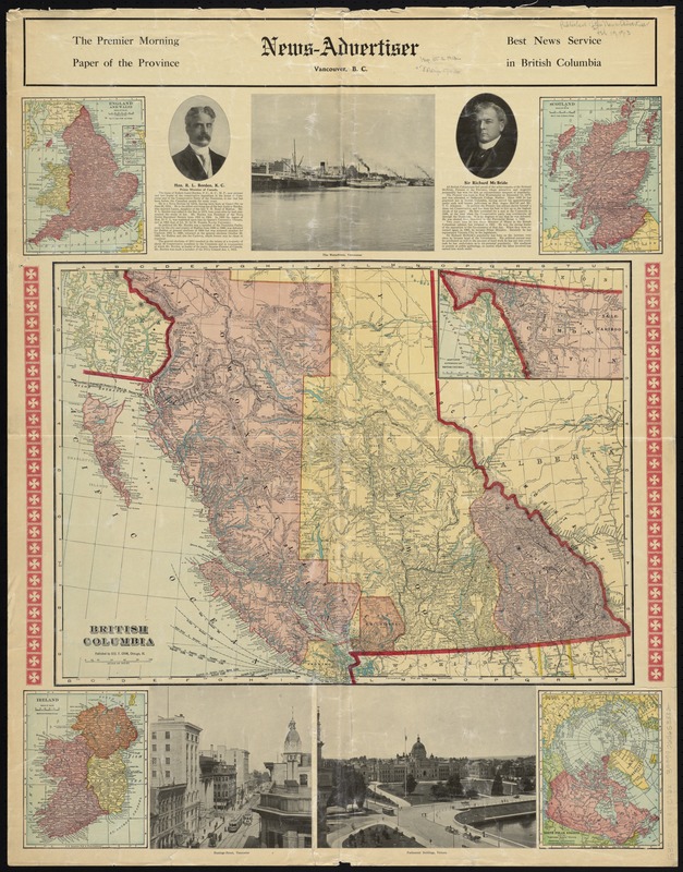
British Columbia
Item Information
- Title:
- British Columbia
- Creator:
- Cram, George Franklin, 1841-1928
- Date:
-
[1913]
- Format:
-
Maps/Atlases
- Location:
-
Boston Public Library
Norman B. Leventhal Map & Education Center - Collection (local):
-
Norman B. Leventhal Map & Education Center Collection
- Subjects:
-
British Columbia--Maps
- Places:
-
CanadaProvince of British Columbia (province)
- Extent:
- 1 map : col. ; 44 x 60 cm., on sheet 90 x 70 cm.
- Terms of Use:
-
No known copyright restrictions.
No known restrictions on use.
- Publisher:
-
Vancouver, B.C :
News-Advertiser
- Scale:
-
Scale [ca. 1:2,450,000]
- Language:
-
English
- Notes:
-
Relief shown by hachures.
Inset: Northern Extension of British Columbia.
Ancillary maps: England and Wales -- Scotland -- Ireland -- North Polar Regions.
Includes text, illustrations, and portraits of R. L. Borden and Richard McBride.
Tables and text on verso.
Bound along top edge and issued with 2 other maps: The Dominion of Canada/Intermediate series United States -- Spherical projection world.
- Notes (date):
-
This date is inferred.
- Identifier:
-
06_01_008424
- Call #:
-
G3510 1913 .C73x
- Barcode:
-
39999065653832


