Toggle navigation
LMEC Home
Exhibitions
Georeferencing
Tools for Teachers
Collections
My Favorites
Sign Up / Log In
Search
Search the map portal
Map Collection
Map Collection
Map Sets
Search
Search
Search for
Search In
All Fields
Creator
Title
Subject
Place
Search All Digital Collections
Advanced Search
13683 Results
Filter your Search
Place
North and Central America
10,345
United States
8,476
Massachusetts
2,789
Suffolk (county)
1,677
Boston
1,633
Europe
1,417
Canada
950
New York
649
more
Place
»
Topic
Boston (Mass.)--Maps
747
City planning--Massachusetts--Boston--Maps
418
United States--History--Revolution, 1775-1783--Maps
329
United States--Maps
322
Real property--Massachusetts--Boston--Maps
254
Urban renewal--Massachusetts--Boston--Maps
254
Massachusetts--Maps
231
Insurance surveys
197
more
Topic
»
Date
Date range begin
–
Date range end
Current results range from
1482
to
2023
View distribution
Creator
United States. Hydrographic Office
597
Boston Redevelopment Authority
404
Des Barres, Joseph F. W. (Joseph Frederick Wallet), 1722-1824
247
Royal United Services Institute for Defence and Security Studies
160
Jefferys, Thomas, -1771
154
George, III, King of Great Britain, 1738-1820
152
George, IV, King of Great Britain, 1762-1830
151
O.H. Bailey & Co
148
more
Creator
»
Format
Maps/Atlases
13,502
Manuscripts
985
Prints
102
Books
49
Drawings/Illustrations
44
Photographs
15
Objects/Artifacts
13
Documents
7
more
Format
»
Georeferenced
Yes
979
No
12,704
Collection
Norman B. Leventhal Map & Education Center Collection
9,098
American Revolutionary War-Era Maps
3,305
Boston and New England Maps
2,915
Urban Maps
2,473
Maritime Charts and Atlases
1,169
William L. Clements Library Collection
910
Library of Congress Collection
618
Boston Redevelopment Authority Collection
475
more
Collection
»
Available to use
No known restrictions
10,249
Creative Commons license
1,678
Search Constraints
Sort by relevance
relevance
title
date (asc)
date (desc)
Number of results to display per page
20 per page
10
per page
20
per page
50
per page
100
per page
View results as:
grid view
map view
Search Results
13001.
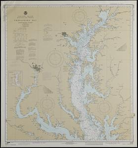
United States--east coast, Maryland and Virginia, Chesapeake Bay, northern part
13002.
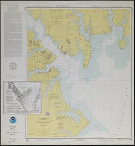
United States--east coast, Maryland, Annapolis Harbor
13003.
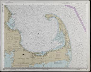
United States--east coast, Massachusetts, Cape Cod Bay
13004.
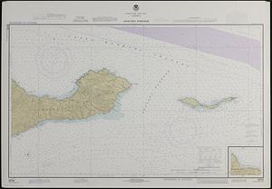
United States--west coast, California, Anacapa Passage
13005.
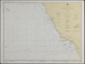
United States--west coast, California, Point Dume to Purisima Point
13006.
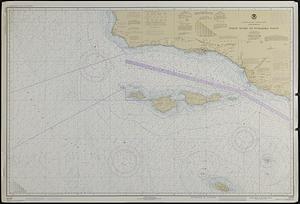
United States--west coast, California, San Diego to Cape Mendocino
13007.
Uniuersalior cogniti orbis tabula ex recentibus confecta obseruationibus
13008.
Uniuersi orbis seu terreni globi in plano effigies
13009.
[Universal map of China]
13010.
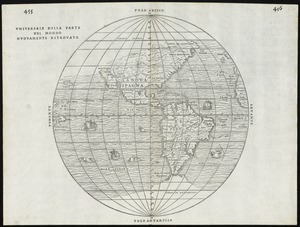
Universale della parte del mondo nuovamente ritrovata
13011.
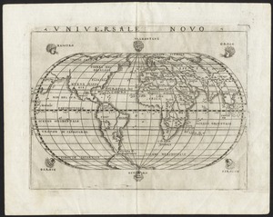
Universale novo
13012.
Universalis de terrao orarium ex vera recen [...] traditione
13013.
University and city of Oxford
13014.
Unsigned and untitled T-O world map
13015.
Upper Canada and the Great Lakes region
13016.
Upper Geyser Basin
13017.
Upper New York, Vermont, and Massachusetts
13018.
Upper Salem and part of the tounds [sic] joining it for two or three miles distance
13019.
Uprooted people of the U.S.A.
13020.
Upton, Massachusetts : 1888
‹ Prev
Next ›
1
2
…
647
648
649
650
651
652
653
654
655
…
684
685


![[Universal map of China]](https://bpldcassets.blob.core.windows.net/derivatives/images/commonwealth:qb98n8079/image_thumbnail_300.jpg)
![Universalis de terrao orarium ex vera recen [...] traditione](https://bpldcassets.blob.core.windows.net/derivatives/images/commonwealth:hq37vv39x/image_thumbnail_300.jpg)


![Upper Salem and part of the tounds [sic] joining it for two or three miles distance](https://bpldcassets.blob.core.windows.net/derivatives/metadata/commonwealth-oai:8k71sf77k/image_thumbnail_300.jpg)

