United States--east coast, Maryland, Annapolis Harbor
Item Information
- Title:
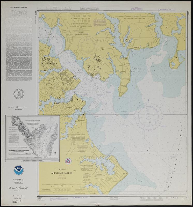
- United States--east coast, Maryland, Annapolis Harbor
- Title (alt.):
-
One Billionth Chart
- Cartographer:
- National Ocean Survey
- Name on Item:
-
National Ocean Survey
- Date:
-
1976
- Format:
-
Maps/Atlases
- Genre:
-
Nautical charts
Bathymetric maps
- Location:
-
Boston Public Library
Norman B. Leventhal Map & Education Center - Collection (local):
-
Applied Geographics, Inc. Records
- Subjects:
-
Annapolis (Md.)--Maps
Nautical charts--Maryland--Annapolis Region--Maps
- Places:
-
MarylandAnne Arundel (county)Annapolis
- Extent:
- 1 map : color ; 88 x 71 cm, on sheet 99 x 92 cm
- Terms of Use:
-
No known copyright restrictions.
No known restrictions on use.
- Publisher:
-
Washington, D.C. :
U.S. Dept. of Commerce, National Oceanic and Atmospheric Administration, National Ocean Survey
- Edition:
- 16th ed.
- Scale:
-
Scale 1:10,000
- Projection:
- Mercator projection
- Language:
-
English
- Notes:
-
Depth shown by gradient tints, soundings, and isolines.
Includes text, facsimile inset of "The Harbor of Annapolis" map published in 1846, and American Revolution Bicentennial logo.
Includes 2 tables and 2 compasses showing Magnetic North slightly to upper left.
"Jan. 3/76, 12283, (formerly C & GS 385)"--Margin.
- Identifier:
-
06_01_019102
- Call #:
-
AppGeo Folder 33 no.16


