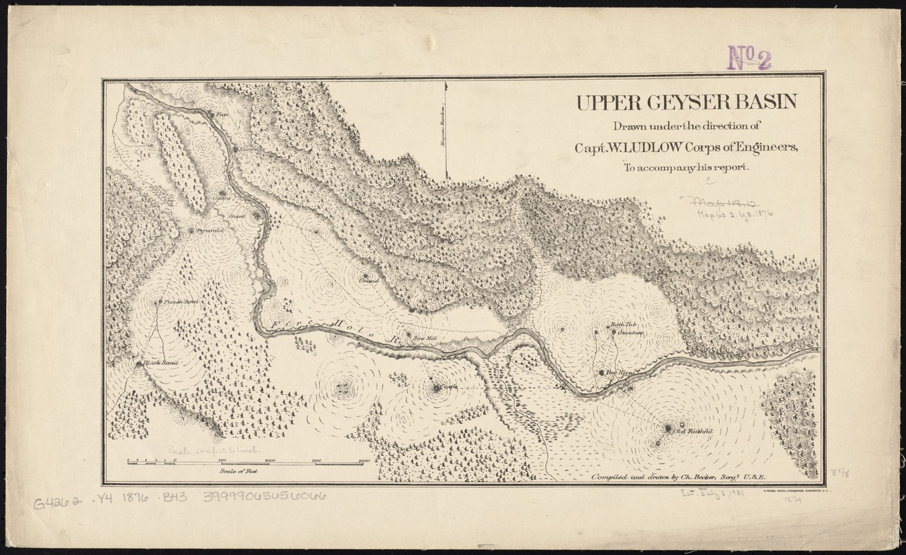
Upper Geyser Basin
Item Information
- Title:
- Upper Geyser Basin
- Description:
-
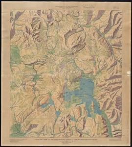
Yellowstone National Park – the United States’ first such park – is also home to more than 10,000 hydrothermal features, including 300 geysers, which result from volcanic activity. They occur when magma or very hot rocks deep in the earth heat groundwater. A geyser’s spout of steam and hot water takes place when the pressure of the near-boiling underground water is released. The entire Yellowstone region is volcanically and seismically active, and is known as a “supervolcano.” This map illustrates Yellowstone’s Upper Geyser Basin – home to the famous Old Faithful geyser – just four years after the park was established.
- Creator:
- Becker, Charles.
- Name on Item:
-
drawn under the direction of Capt. W. Ludlow, Corps of Engineers, to accompany his report ; compiled and drawn by Ch. Becker, Sergt., U.S.E.
- Date:
-
[1876]
- Format:
-
Maps/Atlases
- Location:
-
Boston Public Library
Norman B. Leventhal Map & Education Center - Collection (local):
-
Norman B. Leventhal Map & Education Center Collection
- Subjects:
-
Upper Geyser Basin (Wyo.)--Maps
Yellowstone National Park--Maps
- Places:
-
WyomingTeton (county)Upper Geyser Basin
Yellowstone National Park
- Extent:
- 1 map ; 22 x 39 cm.
- Terms of Use:
-
No known copyright restrictions.
No known restrictions on use.
- Publisher:
-
Washington :
Corps of Engineers
- Scale:
-
Scale [ca. 1:6,000]
- Language:
-
English
- Notes:
-
Relief shown by hachures.
- Notes (date):
-
This date is inferred.
- Notes (exhibitions):
-
Exhibited: "Beneath Our Feet: Mapping the World Below" organized by the Norman B. Leventhal Map Center at the Boston Public Library, 2017-2018.
- Identifier:
-
06_01_008785
- Call #:
-
G4262.Y4 1876 .B43
- Barcode:
-
39999065656066