Panoramic view of the Yellowstone National Park, Wyoming-Montana-Idaho
Item Information
- Title:
- Panoramic view of the Yellowstone National Park, Wyoming-Montana-Idaho
- Description:
-
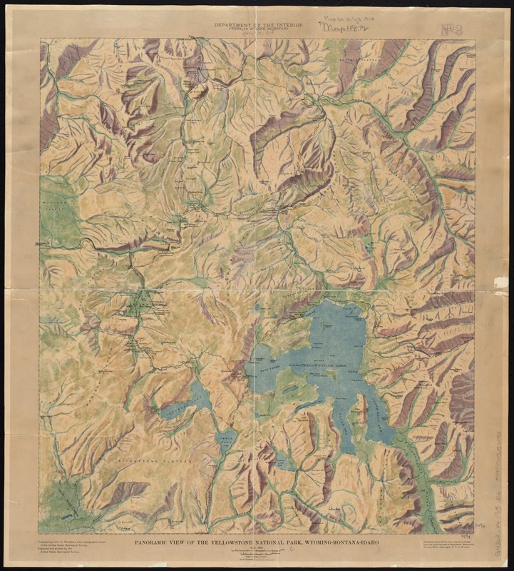
This shaded-relief map by John Renshawe of the U.S. Geological Survey illustrates the varied topography, or natural features, encompassed by Yellowstone National Park. Mountain ranges, lakes, rivers, and hydrothermal features such as steam vents, fumaroles, paint pots, mud cauldrons, geysers, hot springs and more make up this varied landscape. The Upper Geyser Basin, home to Old Faithful, is located west of Yellowstone Lake. Renshawe has applied color in a painterly style to indicate relief, making this map look more like a work of art than a typical topographic map which uses contour lines and minimal color to indicate relief.
- Creator:
- Renshawe, John H.
- Name on Item:
-
prepared by John H. Renshawe from topographic sheets of the United States Geological Survey.
- Date:
-
[1914]
- Format:
-
Maps/Atlases
- Location:
-
Boston Public Library
Norman B. Leventhal Map & Education Center - Collection (local):
-
Norman B. Leventhal Map & Education Center Collection
- Subjects:
-
Yellowstone National Park--Maps
- Places:
-
Yellowstone National Park
- Extent:
- 1 map : col. ; 53 x 47 cm.
- Terms of Use:
-
No known copyright restrictions.
No known restrictions on use.
- Publisher:
-
[Washington, D.C.] :
United States Geological Survey
- Scale:
-
Scale 1:187,500
- Language:
-
English
- Notes:
-
Relief shown by shading.
Date based on date of acquisition.
- Notes (date):
-
This date is inferred.
- Notes (exhibitions):
-
Exhibited: "Beneath Our Feet: Mapping the World Below" organized by the Norman B. Leventhal Map Center at the Boston Public Library, 2017-2018.
- Identifier:
-
06_01_008784
- Call #:
-
G4262.Y4 1915 .R46
- Barcode:
-
39999065656058
- LCCN:
-
97683603


