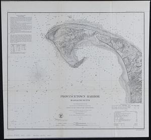
United States--east coast, Massachusetts, Cape Cod Bay

Item Information
- Title:
- United States--east coast, Massachusetts, Cape Cod Bay
- Cartographer:
- United States. National Ocean Service
- Name on Item:
-
National Ocean Service
- Date:
-
1984
- Format:
-
Maps/Atlases
- Genre:
-
Nautical charts
- Location:
-
Boston Public Library
Norman B. Leventhal Map & Education Center - Collection (local):
-
Applied Geographics, Inc. Records
- Subjects:
-
Cape Cod Bay (Mass.)--Maps
Cape Cod Bay (Mass.)--Navigation
Atlantic Coast (Mass.)--Maps
- Places:
-
MassachusettsCape Cod Bay
- Extent:
- 1 map : color ; 79 x 102 cm
- Terms of Use:
-
No known copyright restrictions.
No known restrictions on use.
- Publisher:
-
Washington, D.C. :
U.S. Department of Commerce, National Oceanic and Atmospheric Administration, National Ocean Service
- Edition:
- 27th ed., Oct 27/84.
- Scale:
-
Scale 1:80,000 at lat. 41°53'
- Projection:
- Mercator projection
- Language:
-
English
- Notes:
-
Depths shown by isolines and soundings.
Relief shown by contours, hachures, and spot heights.
"Soundings in feet."
"LORAN-C overprinted."
Includes tidal information.
- Identifier:
-
06_01_019098
- Call #:
-
AppGeo Folder 33 no.12