[Universal map of China]
![[Universal map of China]](https://bpldcassets.blob.core.windows.net/derivatives/images/commonwealth:qb98n8079/image_access_800.jpg)
Item Information
- Title:
- [Universal map of China]
- Description:
-
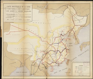
A Chinese view of the world is provided by this unusual woodcut and hand-colored map. The two vignettes depict the world in the European context of two hemispheres. The hemisphere in the upper left, titled Hai guo wen jian lu si hai zong tu and showing the eastern hemisphere, is based on a map in Chen Lunjiong's Hai guo wen jian lu, published in 1730. The hemisphere in the upper right, titled Nei ban shan hai tian wen quan tu and showing the world centered on the Pacific Ocean, is derived from Matteo Ricci's Kunyu wanguo quan tu. The map at the bottom, titled Yu di quan tu, is based on a map drawn by Huang Zongxi in 1673. The primary emphasis is China, but Europe and the British Isles are represented as a very thin sliver of uncolored land and islands in the upper left corner. The seventeen provinces of China dominate the main section of the map. They are outlined and colored, with cities, towns, and villages indicated by woodcut stamps of their names. Rivers, mountains, the Great Wall of China and the Gobi Desert are also depicted using simple pictorial symbols. As is typical for world maps from non-European cultures, distant lands are depicted as mysterious and exotic. For example, a note on Brazil identifies it as the "land of the cannibals." A late 19th-century commentator has translated into English several of the Chinese labels and added annotations. For example, a note in the lower right margin refers to a rebellion in "Yung Ngan," in reference to Yang ngan county in Guangxi Province (marked "9" on map), where the Taiping Rebellion started in 1850.
- Creator:
- Ma, Junliang, active 18th century-19th century
- Date:
-
[ca. 1850]
- Format:
-
Maps/Atlases
- Location:
-
Boston Public Library
Norman B. Leventhal Map & Education Center - Collection (local):
-
Norman B. Leventhal Map & Education Center Collection
- Subjects:
-
World maps
China--Maps
- Places:
-
China
World
- Extent:
- 1 map : col. ; 133 x 72 cm.
- Terms of Use:
-
No known copyright restrictions.
No known restrictions on use.
- Publisher:
-
S.l :
s.n.
- Scale:
-
Scale not given.
- Language:
-
Chinese
- Table of Contents:
-
Yu di quan tu
Hai guo wen jian lu si hai zong tu
Nei ban shan hai tian wen quan tu.
- Notes:
-
Title supplied by cataloger.
Early 19th-century reproduction of a woodblock print map originally printed in the 1790s.
Relief shown pictorially.
Includes text, list of provinces with numbers of cities, towns and villages, and two hemispheres.
Map of the eastern hemisphere in upper left, titled Hai guo wen jian lu si hai zong tu, is based on a map in Chen Lunjiong's Hai guo wen jian lu, published in 1730.
Hemisphere in upper right showing the world centered on the Pacific Ocean, titled Nei ban shan hai tian wen quan tu, is derived from Matteo Ricci's Kunyu wanguo quan tu.
Main map based on map of China drawn by Huang Lizhou in 1673.
Text block in upper left signed Jianshan (courtesy name of Junliang Ma); text block in upper right signed Ma Junliang of Shimen, Zhejiang province.
Exhibited in “Faces and Places,” at the Boston Public Library, Boston, MA, October 2003 - September 2004. MB (BRL)
- Notes (citation):
-
Smith, R.J. Mapping China's world, 69-75
- Notes (exhibitions):
-
Exhibited: "Journeys of the Imagination" organized by the Norman B. Leventhal Map Center at the Boston Public Library, 2006.
- Identifier:
-
05_04_000042
- Call #:
-
G7820 1850 .C4
- Barcode:
-
39999052507306