Toggle navigation
LMEC Home
Exhibitions
Georeferencing
Tools for Teachers
Collections
My Favorites
Sign Up / Log In
Search
Search the map portal
Map Collection
Map Collection
Map Sets
Search
Search
Search for
Search In
All Fields
Creator
Title
Subject
Place
Search All Digital Collections
Advanced Search
51 Results
My Search
Start Over
Maps, Panama
Remove constraint Maps, Panama
Filter your Search
Place
North and Central America
30
Panama
27
Colombia
12
United States
9
South America
8
Colón
7
Venezuela
5
Mesoamerica
4
more
Place
»
Topic
Panama--Maps--Early works to 1800
7
Colombia--Maps--Early works to 1800
6
Venezuela--Maps--Early works to 1800
5
Central America--Maps
4
Panama--Maps
4
United States--Maps
4
Mexico--Maps
3
Panama Canal (Panama)--Maps
3
more
Topic
»
Date
Date range begin
–
Date range end
Current results range from
1630
to
1954
View distribution
Creator
United States. Hydrographic Office
8
Buache, Philippe, 1700-1773
4
Franke, M. (Max)
3
Jefferys, Thomas, -1771
3
Moll, Herman, d. 1732
3
Blaeu, Willem Janszoon, 1571-1638
2
Dudley, Robert, Sir, 1574-1649
2
Kolb, C. A. (Charles A.)
2
more
Creator
»
Format
Maps/Atlases
51
Manuscripts
1
Georeferenced
Yes
5
No
46
Collection
Norman B. Leventhal Map Center Collection
43
Maritime Charts and Atlases
15
American Revolutionary War-Era Maps
11
William L. Clements Library Collection
7
Richard H. Brown Revolutionary War Map Collection at Mount Vernon
1
Available to use
No known restrictions
43
Creative Commons license
1
Search Constraints
Sort by title
relevance
title
date (asc)
date (desc)
Number of results to display per page
20 per page
10
per page
20
per page
50
per page
100
per page
View results as:
grid view
map view
Search Results
1.
Aeronautical view of the Panama Canal
2.
Bird's-eye view of the Panama Canal
3.
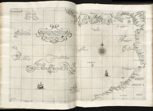
Carta particolare del' mare del' Zur che comincia con il' capo S. Francesco nel' Peru è finisce con il' capo S. Lazaro nella...
4.
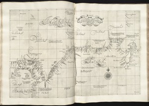
Carta particolare del'India Occidentale che comincia con il Capo S. Romano nel' mare del' nort è finisce con il' Rio Coquele
5.
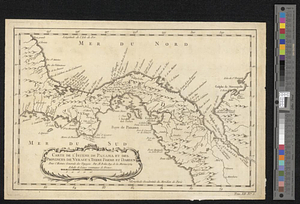
Carte de l'isthme de Panama depuis Panama jusques à la rivière de Nata du coté du sud, et depuis Porto Bello, jusques à la...
6.
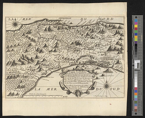
Carte de l'isthme de Panama et des provinces de Veragua Terre Ferme er Darien : pour l'histoire générale des voyages
7.
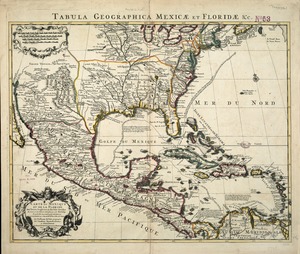
Carte du Mexique et de la Florida : des terres angloises et des Isles Antilles, du cours et des environs de la Riviere de...
8.
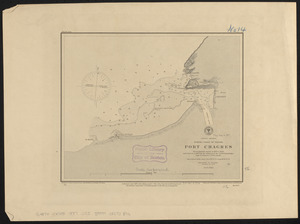
Central America, north coast of Panama, Port Chagres : from a British survey in 1829 & 1840, and a survey in 1875 by the...
9.
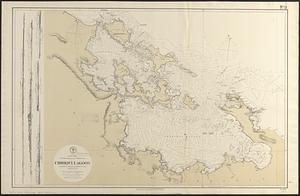
Central America, southern shore of the Caribbean Sea, Chiriqui Lagoon
10.
The countries of the Caribbean : including Mexico, Central America, the West Indies and the Panama Canal
11.
Diagram showing the Changuinola Railroad lines
12.
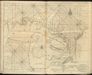
A draft of the Golden & adjacent Islands, with part of ye Isthmus of Darien as it was taken by Capt. Ienefer where ye Scots...
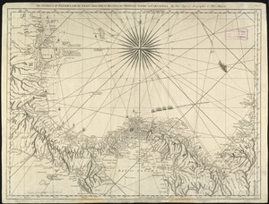
13.
An exact draught of the gulf of Darien & the coast to Porto Bello with Panama in the south sea & the Scotch settlement in...
14.
General railway map engraved expressly for the Official guide of the railways and steam navigation lines of the United States,...
15.
The Isthmus of Panama with the coast from Great River on the Moskito shore to Cartagena
16.
Map of Central America, Cuba, Porto Rico, and the islands of the Caribbean Sea
17.
Map of Chautauque County, New York : from actual surveys
18.
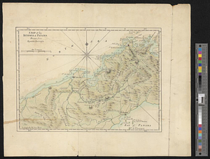
A map of part of the Isthmus of Darien : shewing the communication with Panama, from Portobello & Chagre both by land, and by...
19.
A map of the isthmus of Panama drawn from Spanish surveys
20.
Map of the United States of America, the British provinces, Mexico, the West Indies and Central America, with part of New...
‹ Prev
Next ›
1
2
3