Toggle navigation
LMEC Home
Exhibitions
Georeferencing
Tools for Teachers
Collections
My Favorites
Sign Up / Log In
Search
Search the map portal
Map Collection
Map Collection
Map Sets
Search
Search
Search for
Search In
All Fields
Creator
Title
Subject
Place
Search All Digital Collections
Advanced Search
163 Results
My Search
Start Over
1876
Remove constraint 1876
Filter your Search
Place
North and Central America
116
United States
100
Massachusetts
43
South America
21
Suffolk (county)
19
Boston
17
Chile
12
Europe
12
more
Place
»
Topic
Coasts--Chile--Maps
11
Long Trail (Vt.)--Maps
9
Trails--Vermont--Maps
9
Boston (Mass.)--Maps
8
Hiking--Vermont--Maps
5
Gettysburg (Pa.)--Maps
4
Gettysburg, Battle of, Gettysburg, Pa., 1863--Maps
4
Hiking--Vermont--Long Trail--Maps
4
more
Topic
»
Date
Date range begin
–
Date range end
Current results range from
1760
to
1932
View distribution
Creator
United States. Hydrographic Office
50
Boston (Mass.). Park Commissioners
9
Congdon, Herbert Wheaton, 1876-1965
9
Campbell-Copeland, T. (Thomas)
7
Harper & Brothers
7
Bailey, H. H. (Howard Heston), 1836-1878
6
O.H. Bailey & Co
6
Bachelder, John B. (John Badger), 1825-1894
4
more
Creator
»
Format
Maps/Atlases
161
Manuscripts
3
Books
2
Ephemera
1
Georeferenced
Yes
14
No
149
Collection
Norman B. Leventhal Map & Education Center Collection
159
Boston and New England Maps
52
Maritime Charts and Atlases
52
Urban Maps
49
American Revolutionary War-Era Maps
2
David Judkins Weaver Papers
1
Library of Congress Collection
1
MacLean Collection Map Library
1
more
Collection
»
Available to use
No known restrictions
158
Creative Commons license
2
Search Constraints
Sort by relevance
relevance
title
date (asc)
date (desc)
Number of results to display per page
20 per page
10
per page
20
per page
50
per page
100
per page
View results as:
grid view
map view
Search Results
121.
Plan of Mayflower Park situated in the town of Braintree owned by the Braintree Land Associates
122.
Proposed route of the Boston and Mystic Valley railroad
123.
Taunton River : drainage area 450 sq. miles
124.
Topographical map of Pittsfield, Berkshire Co., Mass : from actual surveys and records
125.
Traveler's rail road map of the United States to accompany "Boston to Washington" Riverside Series Centennial Guides
126.
United States International Exhibition : Bird's-eye view of Fairmount Park, showing the centennial buildings in course of...
127.
Upper Geyser Basin
128.
Valley of Blackstone River within the state of Mass
129.
Back Bay and Parker Hill parks : Parker Hill and Jamaica parkways : Boston and Roxbury districts
130.
Brighton park : Brighton district
131.
Charles River embankment : Boston district
132.
Chart of Jamaica Pond and plan of surroundings
133.
Jamaica Park and Bussey Farm Parkway : West Roxbury district
134.
[Plan of the cove between Savin Hill and Commercial Point, Dorchester]
135.
South Bay and Savin Hill parks : Dorchester district
136.
West Roxbury Park : West Roxbury district
137.
West Wood Island Park, East Boston district
138.
[Fort Moultrie, Charlestown, South Carolina]
139.
Baltic Sea : additional plans to chart no. 293
140.
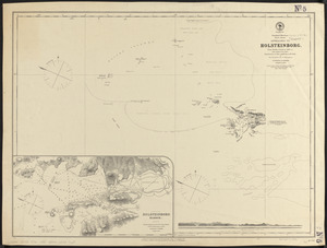
Greenland, west coast, Davis Strait, approaches to Holsteinborg : from British surveys of 1853-4, with additions to 1875
‹ Prev
Next ›
1
2
3
4
5
6
7
8
9


![[Plan of the cove between Savin Hill and Commercial Point, Dorchester]](https://bpldcassets.blob.core.windows.net/derivatives/images/commonwealth:js956k66d/image_thumbnail_300.jpg)


![[Fort Moultrie, Charlestown, South Carolina]](https://bpldcassets.blob.core.windows.net/derivatives/images/commonwealth:9s161d527/image_thumbnail_300.jpg)