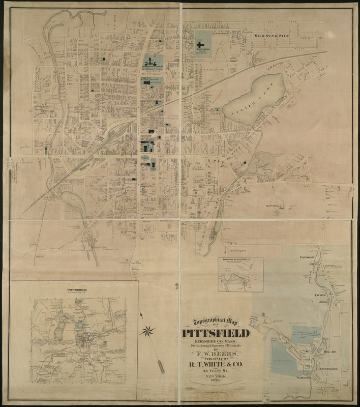
Topographical map of Pittsfield, Berkshire Co., Mass : from actual surveys and records
Item Information
- Title:
- Topographical map of Pittsfield, Berkshire Co., Mass : from actual surveys and records
- Creator:
- Beers, F. W. (Frederick W.)
- Name on Item:
-
by F.W. Beers.
- Date:
-
1876
- Format:
-
Maps/Atlases
- Location:
-
Boston Public Library
Norman B. Leventhal Map & Education Center - Collection (local):
-
Norman B. Leventhal Map & Education Center Collection
- Subjects:
-
Real property--Massachusetts--Pittsfield--Maps
Landowners--Massachusetts--Pittsfield--Maps
Pittsfield (Mass.)--Maps
- Places:
-
MassachusettsBerkshire (county)Pittsfield
- Extent:
- 1 map : col. ; 146 x 126 cm.
- Terms of Use:
-
No known copyright restrictions.
No known restrictions on use.
- Publisher:
-
New York :
R.T. White & Co.
- Scale:
-
Scale 1:2,400.
- Language:
-
English
- Notes:
-
Oriented with north toward the upper left.
Insets: Pittsfield.--Tillotson & Collin's Mills, town of Pittsfield.
- Identifier:
-
06_01_005429
- Call #:
-
G3764.P5G46 1876 .B4x
- Barcode:
-
39999059014249
- LCCN:
-
gm 70002593