Toggle navigation
LMEC Home
Exhibitions
Georeferencing
Tools for Teachers
Collections
My Favorites
Sign Up / Log In
Search
Search the map portal
Map Collection
Map Collection
Map Sets
Search
Search
Search for
Search In
All Fields
Creator
Title
Subject
Place
Search All Digital Collections
Advanced Search
980 Results
My Search
Start Over
More Like
commonwealth-oai:pn89j511c
Remove constraint More Like: commonwealth-oai:pn89j511c
Filter your Search
Place
North and Central America
954
United States
686
Canada
205
New York
199
Quebec
111
Pennsylvania
90
Virginia
73
New Jersey
62
more
Place
»
Topic
United States--History--Revolution, 1775-1783--Maps
306
United States--History--French and Indian War, 1754-1763--Maps
149
Pennsylvania--Maps
50
Virginia--Maps
47
Saint Lawrence River--Maps
43
New York (State)--Maps
32
Newport (R.I.)--Maps
27
Maryland--Maps
25
more
Topic
»
Date
Date range begin
–
Date range end
Current results range from
1700
to
1925
View distribution
Creator
Rocque, Mary Ann
29
Bellin, Jacques Nicolas, 1703-1772
26
Holland, Samuel, 1728-1801
25
Montrésor, John, 1736-1799
25
Jefferys, Thomas, -1771
24
Clinton, Henry, Sir, 1738?-1795
19
Robert Sayer and John Bennett (Firm)
15
Hills, John, active 1777-1819
13
more
Creator
»
Format
Maps/Atlases
964
Drawings/Illustrations
11
Documents
5
Manuscripts
1
Prints
1
Georeferenced
Yes
27
No
953
Collection
American Revolutionary War-Era Maps
922
William L. Clements Library Collection
909
Norman B. Leventhal Map & Education Center Collection
61
American Antiquarian Society Collection
9
MacLean Collection Map Library
1
Urban Maps
1
Available to use
No known restrictions
61
Search Constraints
Sort by relevance
relevance
title
date (asc)
date (desc)
Number of results to display per page
20 per page
10
per page
20
per page
50
per page
100
per page
View results as:
grid view
map view
Search Results
901.
Sketch of the seven dangerous rappids with their true channel : also the appearance the river makes at those places between...
902.
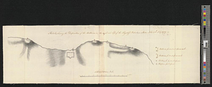
A sketch of the south shore of Lake Ontario between Oswego and Niagara, and from thence up the river to aboute two miles above...
903.
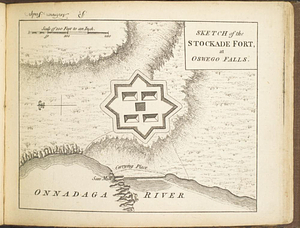
Sketch of the stockade fort, at Oswego Falls
904.
Sketch, shewing the disposition of the batteries, on the right and left, of the Flagstaff Redout : Staten Island, 12th July 1779
905.
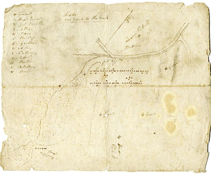
A sketch shewing the situation of 230 acres of land, set apart for his excellency Major General Simcoe, to complete his...
906.
South & North Carolina : an exact map of the boundary line between the provinces of South & North Carolina agreeable to the...
907.
A south view of Oswego, on Lake Ontario, in North America
908.
Southern New York and northern New Jersey
909.
Southern portion of Lake Megantic and the Dead River : Québec July 25th, 1761
910.
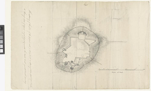
Southwest coast of St. Vincent
911.
Specimen trigesimae sextae partis ex globo terrestri trium pedum Parisin cujus nec non globi Coelestis constructio addito...
912.
St. Clair's camp at later site of Greenville
913.
St. Eustatia topographically drawn & humbly dedicated to his excellency John Vaughan commander in chief of his majestys forces...
914.
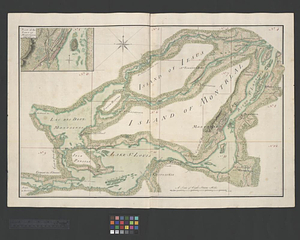
The St. Lawrence River between Coteau des Cedres and Varennes
915.
The St. Lawrence River between Trois Rivières and Grondines Parish
916.
The St. Lawrence River from the Rapids of Richelieu to Cape Torment
917.
St. Paul's Bay; Isle de Coudres; Great Cove; Pt. de Mille Vaches
918.
Stony Point
919.
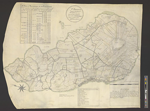
Subdivision of lot no. 12 in the Good Beer Kill tract : performed this 4th day of Octr. 1797
920.
Sullivans Island
‹ Prev
Next ›
1
2
…
42
43
44
45
46
47
48
49