Toggle navigation
LMEC Home
Exhibitions
Georeferencing
Tools for Teachers
Collections
My Favorites
Sign Up / Log In
Search
Search the map portal
Map Collection
Map Collection
Map Sets
Search
Search
Search for
Search In
All Fields
Creator
Title
Subject
Place
Search All Digital Collections
Advanced Search
1254 Results
My Search
Start Over
More Like
commonwealth-oai:g158gg63r
Remove constraint More Like: commonwealth-oai:g158gg63r
Filter your Search
Place
North and Central America
1,224
United States
942
Canada
251
New York
196
Quebec
112
Pennsylvania
61
New Jersey
54
Nova Scotia
49
more
Place
»
Topic
United States--Maps
330
United States--History--Revolution, 1775-1783--Maps
305
United States--History--French and Indian War, 1754-1763--Maps
152
Canada--Maps
55
Saint Lawrence River--Maps
44
Elections--United States--Maps
36
Railroads--United States--Maps
34
New York (State)--Maps
27
more
Topic
»
Date
Date range begin
–
Date range end
Current results range from
1700
to
2023
View distribution
Creator
Paullin, Charles Oscar, 1868 or 1869-1944
70
Wright, John Kirtland, 1891-1969
70
Rocque, Mary Ann
29
Bellin, Jacques Nicolas, 1703-1772
26
Holland, Samuel, 1728-1801
25
Montrésor, John, 1736-1799
25
Jefferys, Thomas, -1771
24
Clinton, Henry, Sir, 1738?-1795
19
more
Creator
»
Format
Maps/Atlases
1,236
Drawings/Illustrations
11
Documents
5
Prints
3
Books
1
Manuscripts
1
Objects/Artifacts
1
Posters
1
Georeferenced
Yes
67
No
1,187
Collection
American Revolutionary War-Era Maps
942
William L. Clements Library Collection
909
Norman B. Leventhal Map & Education Center Collection
312
Maps from AAS
23
MacLean Collection Map Library
9
Boston and New England Maps
2
David Judkins Weaver Papers
2
Mapping Boston Collection
2
more
Collection
»
Available to use
No known restrictions
237
Creative Commons license
5
Search Constraints
Sort by relevance
relevance
title
date (asc)
date (desc)
Number of results to display per page
20 per page
10
per page
20
per page
50
per page
100
per page
View results as:
grid view
map view
Search Results
1161.
A sketch of the east end of the peninsula where on is Hampton
1162.
A sketch of the entrance from the sea to Apalachy and part of the environs
1163.
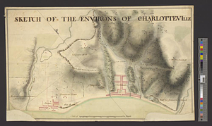
Sketch of the environs of Charlotteville
1164.
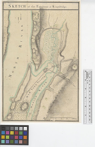
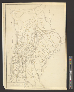
Sketch of the environs of King's bridge
1165.
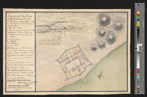
Sketch of the fort at Michilimackinac
1166.
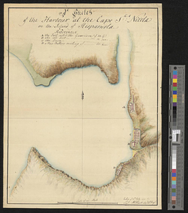
A sketch of the harbour at the Cape Slt: Nicola on the island of Hispaniola
1167.
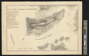
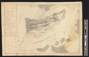
Sketch of the neck and harbour of Majabigwaduce
1168.
Sketch of the neck and harbour of Majabigwaduce 20th Aug. 1779
1169.
Sketch of the position of the army, 17th of June 1780
1170.
Sketch of the position of the army on Long Island upon the morning of the 26th of August, 1776; with the march on the ensuing...
1171.
Sketch of the posts of York Town and Gloucester Point shewing the French and rebel attacks upon the former in October, 1781
1172.
A sketch of the river Missisippi from New Orleans to the Rock of Davion
1173.
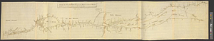
Sketch of the river St. Lawrence from Montreal to the island St. Barnaby on the south side and the islands of Jeremy on the...
1174.
Sketch of the river St: Lawrence from Montreal to the island St: Barnaby on the south side, and the islands of Jeremy on the...
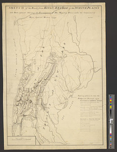
1175.
Sketch of the roads from Kings Bridge to the White Plains and parts ajacent shewing the encampment of his majestys forces under...
1176.
Sketch of the roads from Kings Bridge to the White Plains and parts ajacent shewing the encampment of his majestys forces under...
1177.
Sketch of the roads on the east side of the North River
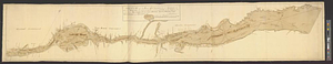
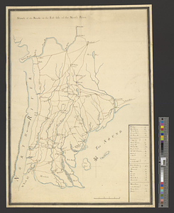
1178.
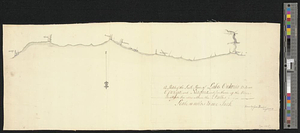
Sketch of the seven dangerous rappids with their true channel : also the appearance the river makes at those places between...
1179.
A sketch of the several Indian roads leading from Fort Pitt to Sioto, Lake Erie &c. : takn. from a draft (made on a tour thro'...
1180.
A sketch of the south shore of Lake Ontario between Oswego and Niagara, and from thence up the river to aboute two miles above...
‹ Prev
Next ›
1
2
…
55
56
57
58
59
60
61
62
63