Toggle navigation
LMEC Home
Exhibitions
Georeferencing
Tools for Teachers
Collections
My Favorites
Sign Up / Log In
Search
Search the map portal
Map Collection
Map Collection
Map Sets
Search
Search
Search for
Search In
All Fields
Creator
Title
Subject
Place
Search All Digital Collections
Advanced Search
1716 Results
My Search
Start Over
More Like
commonwealth-oai:bg25cd491
Remove constraint More Like: commonwealth-oai:bg25cd491
Filter your Search
Place
North and Central America
1,687
United States
1,424
Suffolk (county)
764
Boston
756
Massachusetts
709
Canada
205
New York
195
Quebec
111
more
Place
»
Topic
Boston (Mass.)--Maps
752
United States--History--Revolution, 1775-1783--Maps
330
United States--History--French and Indian War, 1754-1763--Maps
149
City planning--Massachusetts--Boston--Maps
105
Real property--Massachusetts--Boston--Maps
99
Landowners--Massachusetts--Boston--Maps
74
Boston Harbor (Mass.)--Maps
67
Urban renewal--Massachusetts--Boston--Maps
63
more
Topic
»
Date
Date range begin
–
Date range end
Current results range from
1700
to
2023
View distribution
Creator
Boston Redevelopment Authority
114
Rocque, Mary Ann
29
Geo. H. Walker & Co
28
Holland, Samuel, 1728-1801
25
Jefferys, Thomas, -1771
25
Montrésor, John, 1736-1799
25
Bellin, Jacques Nicolas, 1703-1772
24
Boynton, George W., d. 1884
21
more
Creator
»
Format
Maps/Atlases
1,700
Manuscripts
13
Drawings/Illustrations
11
Documents
5
Posters
1
Prints
1
Georeferenced
Yes
101
No
1,615
Collection
American Revolutionary War-Era Maps
942
William L. Clements Library Collection
909
Norman B. Leventhal Map & Education Center Collection
662
Boston and New England Maps
622
Urban Maps
493
Boston Redevelopment Authority Collection
121
Mapping Boston Collection
27
American Antiquarian Society Collection
14
more
Collection
»
Available to use
No known restrictions
729
Creative Commons license
45
Search Constraints
Sort by relevance
relevance
title
date (asc)
date (desc)
Number of results to display per page
20 per page
10
per page
20
per page
50
per page
100
per page
View results as:
grid view
map view
Search Results
381.
Map of the vicinity of Yorktown, Virginia, 1881
382.
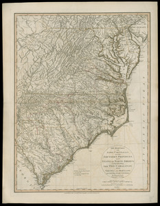
The marches of Lord Cornwallis in the Southern Provinces, now states of North America : comprehending the two Carolinas, with...
383.
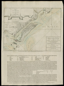
A Plan of Charles Town the capitol of South Carolina, : with the harbour, islands, and forts; the attack on Fort Sulivan, by...
384.
A plan of the attack of Fort Sulivan, near Charles Town in South Carolina : by a squadron of His Majesty's ships, on the 28th....
385.
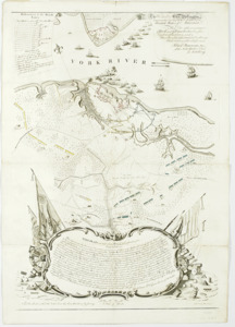
A plan of the entrance of Chesapeak Bay, with James and York Rivers : wherein are shown the respective positions (in the...
386.
Plan of the town and harbour of St. Augustin, in East Florida
387.
Plan of the town of Boston with the attack on Bunkers-Hill in the peninsula of Charlestown the 17th of June 1775
388.
Seat of war in the environs of Philadelphia
389.
Sketch of Bunker Hill Battle
390.
Sketch of the position of the British forces at Elizabeth Town Point after their return from Connecticut Farm, in the province...
391.
The theatre of war in North America, with the roads and a table of the distances
392.
To His Excellency Genl. Washington, Commander in Chief of the armies of the United States of America : this plan of the...
393.
1975 general land use plan
394.
An accurate plan of the town of Boston and its vicinity : exhibiting a ground plan of all the streets, lanes, alleys, wharves,...
395.
Annexation map
396.
Atlas of Massachusetts
397.
Atlas of Massachusetts
398.
Atlas of the city of Boston : Boston proper and Back Bay
399.
Atlas of the city of Boston : Boston proper and Back Bay
400.
Atlas of the city of Boston : Boston proper and Roxbury
‹ Prev
Next ›
1
2
…
16
17
18
19
20
21
22
23
24
…
85
86


![Sketch of the position of the British forces at Elizabeth Town Point after their return from Connecticut Farm, in the province of East Jersey: under the command of his excelly. Leiutt. [sic] Genl. Knyphausen, on the 8th June 1780](https://bpldcassets.blob.core.windows.net/derivatives/images/commonwealth:z603vn418/image_thumbnail_300.jpg)