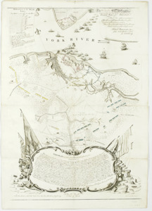
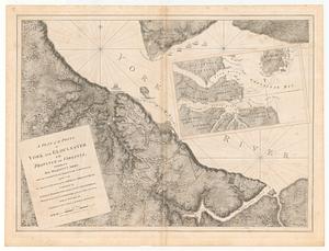
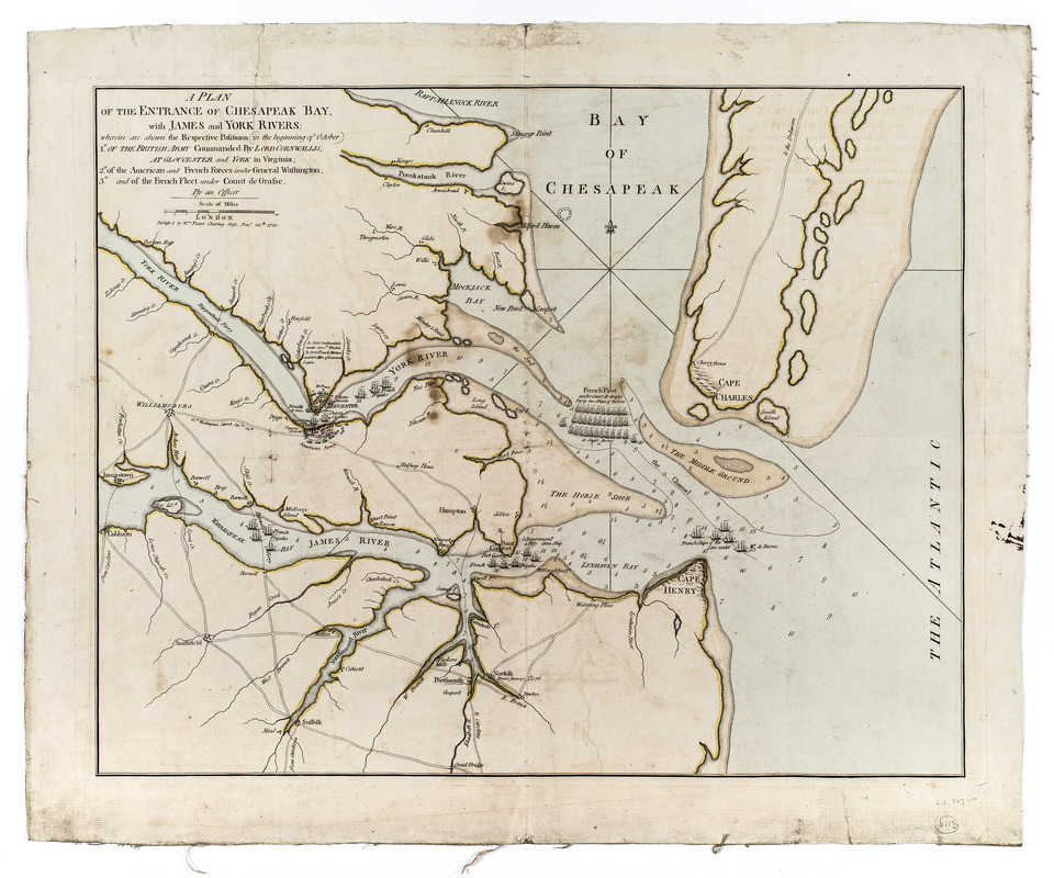
A plan of the entrance of Chesapeak Bay, with James and York Rivers : wherein are shown the respective positions (in the beginning of October) 1° of the British army commanded by Lord Cornwallis, at Gloucester and York in Virginia; : 2° of the American and French forces under General Washington, : 3° and of the French fleet under Count de Grasse
This map is also available in American Revolutionary Geographies Online (ARGO), a collections portal especially built for material relating to the American Revolutionary War Era. Visit ARGO to learn more about this item and explore the historical geography of North America in the late eighteenth century.
Item Information
- Title:
- A plan of the entrance of Chesapeak Bay, with James and York Rivers : wherein are shown the respective positions (in the beginning of October) 1° of the British army commanded by Lord Cornwallis, at Gloucester and York in Virginia; : 2° of the American and French forces under General Washington, : 3° and of the French fleet under Count de Grasse
- Publisher:
- Faden, William, 1749-1836
- Name on Item:
-
by an officer
- Date:
-
1781
- Format:
-
Maps/Atlases
- Location:
- New-York Historical Society
- Collection (local):
-
New-York Historical Society Collection
- Subjects:
-
Yorktown (Va.)--History--Siege, 1781--Maps--Early works to 1800
Yorktown (Va.)--Maps--Early works to 1800
Virginia--Maps--Early works to 1800
Virginia--History--Revolution, 1775-1783--Maps--Early works to 1800
United States--History--Revolution, 1775-1783--Maps
Chesapeake Bay (Md. and Va.)--Maps--Early works to 1800
- Places:
-
York (county)Yorktown
- Extent:
- 1 map : hand colored ; 41 x 52 cm on sheet 48 x 58 cm.
- Terms of Use:
-
No known copyright restrictions.
No known restrictions on use.
- Publisher:
-
[London] :
Published by Wm. Faden Charing Cross
- Scale:
-
Scale 1:250,000
- Language:
-
English
- Catalog Record:
-
https://library.nyu.edu/persistent/lcn/nyu_aleph004267378?institution=NYU&persistent
- Notes:
-
Shows James River peninsula and general positions of armies and the French fleet.
- Notes (citation):
-
LC Maps of North America, 1750-1789, 1465
Nebenzahl, K.A bibliography of printed battle plans, no. 186
- Identifier:
-
93223d_EntranceChesapeakeBay1781_M20_2_16