Toggle navigation
LMEC Home
Exhibitions
Georeferencing
Tools for Teachers
Collections
My Favorites
Sign Up / Log In
Search
Search the map portal
Map Collection
Map Collection
Map Sets
Search
Search
Search for
Search In
All Fields
Creator
Title
Subject
Place
Search All Digital Collections
Advanced Search
8549 Results
My Search
Start Over
More Like
commonwealth:x633fc80h
Remove constraint More Like: commonwealth:x633fc80h
Filter your Search
Place
North and Central America
5,844
United States
4,768
Massachusetts
2,051
Europe
1,359
Suffolk (county)
1,034
Boston
1,007
Canada
448
Asia
422
more
Place
»
Topic
Boston (Mass.)--Maps
577
United States--Maps
273
Real property--Massachusetts--Boston--Maps
174
Massachusetts--Maps
160
Landowners--Massachusetts--Boston--Maps
132
North America--Maps--Early works to 1800
103
New England--Maps
99
Europe--Maps
78
more
Topic
»
Date
Date range begin
–
Date range end
Current results range from
1482
to
2023
View distribution
Creator
United States. Hydrographic Office
594
O.H. Bailey & Co
148
Des Barres, Joseph F. W. (Joseph Frederick Wallet), 1722-1824
123
United States. Post Office Dept
120
Ptolemy, 2nd cent
100
Walling, Henry Francis, 1825-1888
94
Geological Survey (U.S.)
86
Jefferys, Thomas, -1771
85
more
Creator
»
Format
Maps/Atlases
8,490
Manuscripts
215
Prints
56
Books
36
Objects/Artifacts
10
Drawings/Illustrations
8
Posters
4
Georeferenced
Yes
869
No
7,680
Collection
Norman B. Leventhal Map & Education Center Collection
8,549
Boston and New England Maps
2,203
Urban Maps
1,935
Maritime Charts and Atlases
1,081
American Revolutionary War-Era Maps
616
Boston Redevelopment Authority Collection
87
Available to use
No known restrictions
8,408
Creative Commons license
46
Search Constraints
Sort by date (asc)
relevance
title
date (asc)
date (desc)
Number of results to display per page
100 per page
10
per page
20
per page
50
per page
100
per page
View results as:
grid view
map view
Search Results
801.
A map of part of the Isthmus of Darien : shewing the communication with Panama, from Portobello & Chagre both by land, and by...
802.
A map of the Isle of Wight Portsea Halinge, also the islands of Iarsey & Garnsey which are part of Hampshire
803.
A new map containing the English Empire Golf of Mexico Caribes Islands Granada Guiana Amazone and Peru
804.
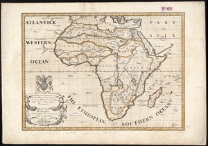
A new map of Africk : shewing its present general divisions cheif cities or towns, rivers, mountain &c. : dedicated to His...
805.
A new map of North America shewing its principal divisions, chief cities, townes, rivers, mountains &c
806.
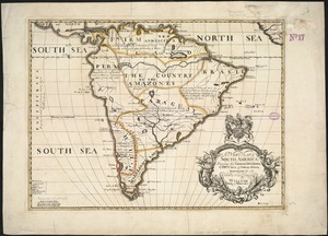
A new map of South America : shewing it's general divisions, chief cities & towns, rivers, mountains &c
807.
A new map of the most considerable plantations of the English in America
808.
A new map of the north part of antient Africa shewing the chiefe people, cities, towns, rivers, mountains, &c. in Mauritania,...
809.
A new map of the terraqueous globe according to the ancient discoveries and most general divisions of it into continents and...
810.
A new map of the terraqueous globe according to the latest discoveries and most general divisions of it into continents and oceans
811.
Virginia Marylandia et Carolina in America septentrionali Brittannorum industria excultæ
812.
The isle of California : New Mexico : Louisiane : The river Misisipi, and the lakes of Canada
813.
A new map of ye seat of war in Italy : comprehending ye Dutchies of Savoy, Milan, Parma Mantua, Modna., Tuscny., &c. : the...
814.
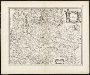
Stato di Milano
815.
L'Amérique Septentrionale & Meridionale divisée en ses principales parties, ou sont distingués les vns des autres les estats...
816.
Archipelagus Atlanticus cum suis insulis Canariis, Hesperidibus et Azoribus
817.
Le Canada, ou Nouvelle France, la Floride, la Virginie, Pensilvanie, Caroline, Nouvelle Angleterre et Nouvelle Yorck, l'Isle de...
818.
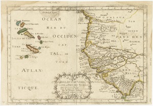
Isles de Cap Verd coste, et pays des Negres
819.
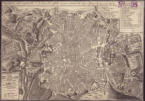
Madrid, ville considérable de la nouvelle Castille, séjour ordinaire des Roys d'Espagne
820.
Evesché de La Rochelle
821.
Les Frontieres de France et d'Italie ou se trouvent les Etats du Duc de Savoye partie de ceux de Milan et de la République de...
822.
Teâtre de la guerre en Amerique telle que'elle est à present possedée par les Espagnols, Anglois, François, et Hollandois...
823.
Carte du Diocese de Narbonne
824.
Comitatus Hannoniae tabula
825.
Ducatus Wurtenbergensis : cum adjacentibus quibusdam Sueviae regionibus
826.
Carte du Gouvernement de l'Amerique
827.
Les costes aux environs de la Riviere de Misisipi : decouvertes par Mr. de la Salle en 1683 et reconnues par Mr. le Chevallier...
828.
Evesché de Luçon : dedié a Monseigneur ... Henry de Barrillon Evesque et Baron de Luçon etc
829.
Mappmonde ou description generale du globe terrestre
830.
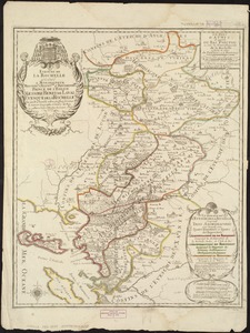
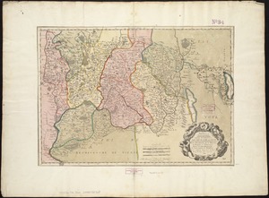
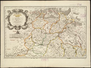
S.R.I. Sueviae Circulus atq[ue] Ducatus una cum insertis et adjacentibus Regionibus, accuratissime in earundem particulares...
831.
La Bretagne : divisée en ses neuf eveschés qui font aussi l'estendue des receptes de la generalité de Nantes
832.
Carte de l'evesché de Nantes
833.
Le Diocese de Toulouse
834.
L'Evesché de Blois, divisé en Archidiaconéz et Doyennéz
835.
A new map of the world according to Wrights alias Mercators projection &c : drawn from the newest and the most exact...
836.
Nouvelle carte de l'Amerique : avec tous ses royaumes, etats, iles, ports, bayes et rivieres, dressée suivant les plus...
837.
Part of New England
838.
Virginia, Maryland, Pennsilvania, east & west New Jarsey
839.
Amplissimae regionis Mississipi seu Provinciae Ludovicianae â R.P. Ludovico Hennepin Francisc Miss in America Septentrionali...
840.
Carte de la Barbarie le la Nigritie et de la Guinée
841.
Cuba en Iamaica : soo als die door Kolumbus ontdekt, en by de Kastilianen bevolkt sijn = Iles de Cuba et de la Jamaique : ainsi...
842.
L'Amerique meridionale
843.
Carte du Diocese de Beziers
844.
Carte particuliere de l'Amerique septentrionale ou sont compris le Destroit de Davids, le Destroit de Hudson, &c
845.
America Septentrionalis novissima : America Meridionalis accuratissima
846.
The English empire in America, Newfound-land, Canada, Hudsons Bay, &c. in plano
847.
An historical map of the Roman Empire and the neighbouring barbarous nations to the year of our Lord four hundred when the...
848.
Insulae de Cabo Verde, Olim Hesperides, sive Gorgades : Belgice de zoute eylanden
849.
This map of South America, according to the newest and most exact observations
850.
A new and exact map of the United Provinces, or Netherlands &c
851.
North America : corrected from the observation communicated to the Royal Society at London and the Royal Academy at Paris
852.
Nova tabula geographica complectens borealiorem Americæ partem : in qua exacte delineatæ sunt Canada sive Nova Francia, Nova...
853.
South America : corrected from the observation communicated to the Royal Societys of London & Paris
854.
Tabula Delphinatus et vicinarum regionum : distributa in principatus comitatus baronias &c. : cum usdem nominibus quae in...
855.
To the Right Honourable John Lord Sommers, Baron of Evesham in ye county of Worcester, president of Her Majesty's most...
856.
To the Right Honourable William, Lord Cowper, Lord High Chancellor of Great Britain, this map of Asia : according to ye newest...
857.
Africa : corrected from the observations of the Royal Society of London and Paris
858.
[Map of eastern Massachusetts and vicinity]
859.
A new & exact map of the coast, countries and islands within ye limits of ye South Sea Company, from ye river Aranoca to Terra...
860.
A new & exact map of the coast, countries and islands within ye limits of ye South Sea Company, from ye river Aranoca to Terra...
861.
Plan de la ville de Bouchain situé sur les rivieres de la Sensette, et de l'Escaut, dans le comté de Hainaut : assiegée par...
862.
Pas kaart van de zuyd kust van Cuba en van geheel Yamaica en and're bygeleegen plaatsen
863.
Pas kaart van t eyland S. Iuan de Porto Rico, met d eylanden daar beoosten
864.
America in praecipuas ipsius partes distributa ad observationes Academiae regiae scientiarum : et exquisitissimas tabulas quae...
865.
Carte de la Mer du Sud et des costes d'Amerique et d'Asie situées sur cette mer : Carte de la Mer du Nord et des costes...
866.
La Floride, suivant les nouvelles observations de Messrs. de l'Academie des Sciences, etc : augmentées de Nouveau
867.
Spagnvola
868.
Carolina is by vertue of a warr and under of hand and se all of the Right Honble. Charles Craven, Esqt. Governr. of this...
869.
Insubres in Segusianis : partie du dioecese, et Archevesché de Lyon : partie méridionale de la Bresse du Bugey, et Valromey,...
870.
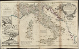
A new map of Italy distinguishing all the sovereignties in it, whether states, kingdoms, dutchies, principalities, republicks,...
871.
A new map of Italy distinguishing all the sovereignties in it, whether states, kingdoms, dutchies, principalities, republicks,...
872.
A new map of the country of Louisiana and of ye river Missisipi in North America discou'd by Mons. de la Salle in ye years...
873.
A map of the West-Indies or the islands of America in the North Sea : with ye adjacent countries; explaning [sic] what belongs...
874.
A map of the West-Indies or the islands of America in the North Sea : with ye adjacent countries; explaning [sic] what belongs...
875.
Orbis Romani descriptio : seu divisio per themata sub Imperatoribus Constantinopolitanis post Heraclii tempora facta
876.
This map of North America, according to ye newest and most exact observations is most humbly dedicated by your Lordship's most...
877.
A chart of the coast of Barbaria with the western, Canaria, & Cape de Verd, isles
878.
Perigrinatie ofte veertich-iarige reyse der kindern Israëls, uyt Egypten door de Roode Zee, ende de woestyne, tot in't...
879.
Totius Americae descriptio nova
880.
Grand theatre de la guerre en Amerique suivant les plus nouvelles observations des Espagnols, Anglois, François & Hollandois
881.
Rhemi : Partie meridionale du dioecese, et archevesché de Rheims en Champagne : la ou sont les Duché, et pairrie partie du...
882.
Rhemi : partie septentrle du Dioecse et Archevesché de Rheims en Champagne : la ou sont les Bailiage, Duche, et Eslection de...
883.
The seat of war in ye North : or a map of the Baltick, with part of the North Sea ... posture of affaris
884.
The seat of war in ye North : or a map of the Baltick, with part of the North Sea ... posture of affaris
885.
Carte de la Louisiane et du cours de Mississipi
886.
Carte nouvelle contenant la partie d'Amerique la plus septentrionale, ou sont exactement dêcrites les provinces suivantes...
887.
A new & correct map of the whole world : shewing ye situation of its principal parts. viz. the oceans, kingdoms, rivers, capes,...
888.
A new map of Libya or old Africk shewing its general divisions, most remarkable countries or people, cities, townes, rivers,...
889.
A new map of the Brittish Isles shewing their antient people, cities, and towns of note, in the time of the Romans : dedicated...
890.
A new map of the Brittish Isles shewing their present genl. divisions, cities, and such other towns, or places, as answer to...
891.
A new map of the English empire in America viz. Virginia, Maryland, Carolina, Pennsylvania, New York, New Iarsey, New England,...
892.
Nieuwe en aldereerste afteekening van 't eyland St. Thomas : met alle desselfs havenen, anker plaatse en geleegentheden is...
893.
L'Amerique Meridionale divisée en ses principales parties
894.
Amplissimae regionis Mississipi seu provinciae Ludovicianae â R.P. Ludovico Hennepin Francisc. Miss. in America septentrionali...
895.
The harbour of Casco Bay and islands adjacent
896.
The harbour of Casco Bay and islands adjacent
897.
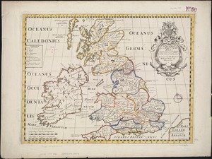
A map of the East-Indies and the adjacent countries, with the settlements, factories and territories, explaning [sic] what...
898.
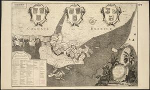
Naaukeurige platte grond van den staat loop van Rio de Berbice met derzelver plantagien in de geoctrojeerde colonie de Berbice
899.
A new map of Great Britain : according to the newest and most exact observations
900.
A new map of the Baltick &c : shewing all the dominions about it with ye great or post roads and principal cross-roads
‹ Prev
Next ›
1
2
…
5
6
7
8
9
10
11
12
13
…
85
86


![S.R.I. Sueviae Circulus atq[ue] Ducatus una cum insertis et adjacentibus Regionibus, accuratissime in earundem particulares provincias divisum](https://bpldcassets.blob.core.windows.net/derivatives/images/commonwealth:cj82kw70k/image_thumbnail_300.jpg)


![[Map of eastern Massachusetts and vicinity]](https://bpldcassets.blob.core.windows.net/derivatives/images/commonwealth:9s161d29f/image_thumbnail_300.jpg)


![A map of the East-Indies and the adjacent countries, with the settlements, factories and territories, explaning [sic] what belongs to England, Spain, France, Holland, Denmark, Portugal &c. with many remarks not extant in any other map](https://bpldcassets.blob.core.windows.net/derivatives/images/commonwealth:cj82ks68x/image_thumbnail_300.jpg)