Pas kaart van de zuyd kust van Cuba en van geheel Yamaica en and're bygeleegen plaatsen
Item Information
- Title:
- Pas kaart van de zuyd kust van Cuba en van geheel Yamaica en and're bygeleegen plaatsen
- Description:
-
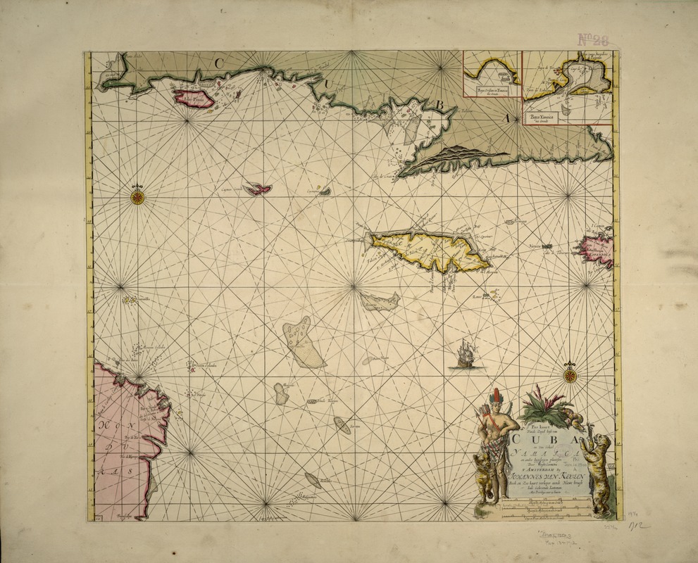
This portolan-style chart was first published by the Dutch chart maker Johannes van Keulen. It appeared in various editions of the van Keulen family's "Zee-Fakkel", and "Zee-Atlas", published from the 1680s through the first half of the 18th century. Both publications included a large collection of navigational charts for various parts of the world. This particular chart extends from the southern coast of Cuba at the top, to the east coast of Honduras at the bottom left, and to the westernmost tip of Haiti at the right. The island of Jamaica is in the center, with two insets at the top of Jamaican bays.
- Creator:
- Keulen, Johannes van, 1654-1715
- Name on Item:
-
Johannes van Keulen.
- Date:
-
[1712]
- Format:
-
Maps/Atlases
- Location:
-
Boston Public Library
Norman B. Leventhal Map & Education Center - Collection (local):
-
Norman B. Leventhal Map & Education Center Collection
- Subjects:
-
Cuba--Maps--Early works to 1800
Jamaica--Maps--Early works to 1800
Antilles, Greater--Early works to 1800
- Places:
-
Greater Antilles (area)
Cuba
Jamaica
- Extent:
- 1 map : col. ; 58 x 51 cm.
- Terms of Use:
-
No known copyright restrictions.
No known restrictions on use.
- Publisher:
-
Amsterdam :
[s.n.]
- Scale:
-
Scale not given.
- Language:
-
Dutch
- Notes:
-
Relief shown pictorially.
Depth shown by soundings.
Appears in De nieuwe groote lightende zee-fakkel, 't vierde deel. 1712.
Exhibited in “Faces and Places,” at the Boston Public Library, Boston, MA, October 2003 - September 2004. MB (BRL)
- Notes (date):
-
This date is inferred.
- Identifier:
-
05_04_000021
- Call #:
-
G4910 1695 .K4
- Barcode:
-
39999052509971


