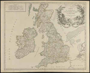
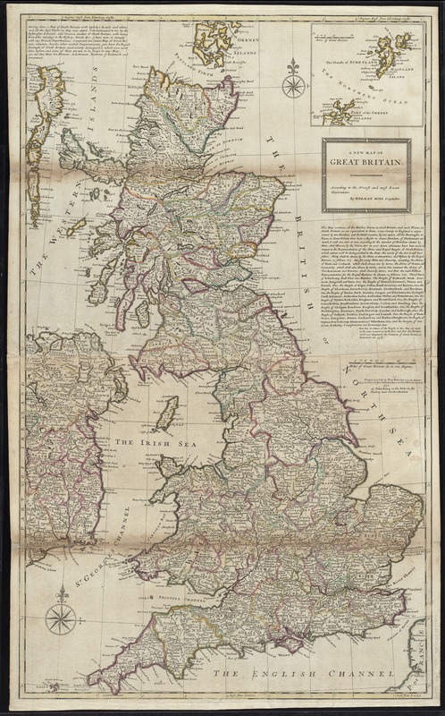
A new map of Great Britain : according to the newest and most exact observations
Item Information
- Title:
- A new map of Great Britain : according to the newest and most exact observations
- Creator:
- Moll, Herman, d. 1732
- Name on Item:
-
by Herman Moll, Geographer.
- Date:
-
[1720?–1729?]
- Format:
-
Maps/Atlases
- Location:
-
Boston Public Library
Norman B. Leventhal Map & Education Center - Collection (local):
-
Norman B. Leventhal Map & Education Center Collection
- Subjects:
-
Great Britain--Maps--Early works to 1800
- Places:
-
United Kingdom
- Extent:
- 1 map : hand col. ; 101 x 60 cm.
- Terms of Use:
-
No known copyright restrictions.
No known restrictions on use.
- Publisher:
-
[London] :
printed and sold by Tho: Bowles ... John Bowles ... and by Iohn King
- Scale:
-
Scale [ca. 1:1,120,000]
- Language:
-
English
- Notes:
-
Relief shown pictorially.
Prime meridians: Edinburgh Castle and London.
Inset: [The islands of Schetland and part of the Orkney Islands].
Includes notes.
Appears in Moll's The world described, [1709-1736], plate 16.
- Identifier:
-
06_01_009676
- Call #:
-
G1015 .M65 1709
- Barcode:
-
30000003877371