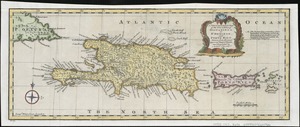
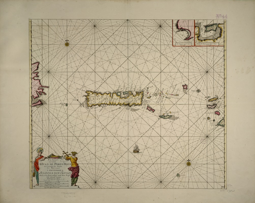
Pas kaart van t eyland S. Iuan de Porto Rico, met d eylanden daar beoosten
Item Information
- Title:
- Pas kaart van t eyland S. Iuan de Porto Rico, met d eylanden daar beoosten
- Title (alt.):
-
Pas kaart van t'eyland S. Iuan de Porto Rico, met d eylanden daar beoosten
- Description:
-
This portolan-style chart was first published by the Dutch chart maker Johannes van Keulen. It appeared in various editions of the van Keulen family's "Zee-Fakkel," and "Zee-Atlas," published from the 1680s through the first half of the 18th century. Both publications included a large collection of navigational charts for various parts of the world. This particular chart focuses on Puerto Rico, but extends eastward to include the Virgin Islands and the Leeward Islands of Anguilla and Saint Martin. There are also two insets depicting the main harbors on Saint Martin and Puerto Rico.
- Creator:
- Keulen, Johannes van, 1654-1715
- Name on Item:
-
Johannes van Keulen.
- Date:
-
[1712]
- Format:
-
Maps/Atlases
- Location:
-
Boston Public Library
Norman B. Leventhal Map & Education Center - Collection (local):
-
Norman B. Leventhal Map & Education Center Collection
- Subjects:
-
San Juan (P.R.)--Maps--Early works to 1800
Puerto Rico--Maps--Early works to 1800
- Places:
-
Puerto Rico (unincorporated territory)
San Juan (area)
- Extent:
- 1 map : col. ; 51 x 58 cm.
- Terms of Use:
-
No known copyright restrictions.
No known restrictions on use.
- Publisher:
-
Amsterdam :
[s.n.]
- Scale:
-
Scale not given
- Language:
-
Dutch
- Notes:
-
Depths shown by soundings.
Appears in De nieuwe groote lightende zee-fakkel, 't vierde deel. 1712.
Exhibited in “Faces and Places,” at the Boston Public Library, Boston, MA, October 2003 - September 2004. MB (BRL)
Cataloging, conservation, and digitization made possible in part by The National Endowment for the Humanities: Exploring the human endeavor.
- Notes (date):
-
This date is inferred.
- Identifier:
-
05_04_000023
- Call #:
-
G4974.S5 1712 .K4
- Barcode:
-
39999052509203