Toggle navigation
LMEC Home
Exhibitions
Georeferencing
Tools for Teachers
Collections
My Favorites
Sign Up / Log In
Search
Search the map portal
Map Collection
Map Collection
Map Sets
Search
Search
Search for
Search In
All Fields
Creator
Title
Subject
Place
Search All Digital Collections
Advanced Search
8650 Results
My Search
Start Over
More Like
commonwealth:x059cc082
Remove constraint More Like: commonwealth:x059cc082
Filter your Search
Place
North and Central America
5,889
United States
4,807
Massachusetts
2,071
Europe
1,392
Suffolk (county)
1,041
Boston
1,014
Canada
449
Asia
437
more
Place
»
Topic
Boston (Mass.)--Maps
583
United States--Maps
279
Real property--Massachusetts--Boston--Maps
175
Massachusetts--Maps
162
Landowners--Massachusetts--Boston--Maps
133
North America--Maps--Early works to 1800
103
New England--Maps
101
Europe--Maps
79
more
Topic
»
Date
Date range begin
–
Date range end
Current results range from
1482
to
2023
View distribution
Creator
United States. Hydrographic Office
595
O.H. Bailey & Co
148
Des Barres, Joseph F. W. (Joseph Frederick Wallet), 1722-1824
123
United States. Post Office Dept
120
Ptolemy, 2nd cent
100
Walling, Henry Francis, 1825-1888
94
Geological Survey (U.S.)
87
Jefferys, Thomas, -1771
85
more
Creator
»
Format
Maps/Atlases
8,590
Manuscripts
215
Prints
56
Books
36
Objects/Artifacts
10
Drawings/Illustrations
8
Posters
5
Georeferenced
Yes
869
No
7,781
Collection
Norman B. Leventhal Map & Education Center Collection
8,649
Boston and New England Maps
2,223
Urban Maps
1,992
Maritime Charts and Atlases
1,083
American Revolutionary War-Era Maps
615
Boston Redevelopment Authority Collection
87
Applied Geographics, Inc. Records
3
Massachusetts Real Estate Atlases
1
Available to use
No known restrictions
8,507
Creative Commons license
47
Search Constraints
Sort by relevance
relevance
title
date (asc)
date (desc)
Number of results to display per page
20 per page
10
per page
20
per page
50
per page
100
per page
View results as:
grid view
map view
Search Results
1.
Atlas of Taunton City, Massachusetts
2.
City of Taunton
3.
Map of Bristol County Massachusetts : based on the trigonometrical survey of the state
4.
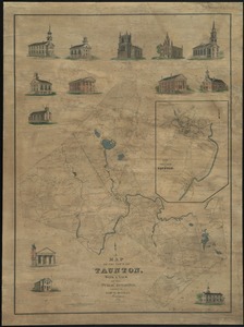
Map of Taunton
5.
Map of the town of Taunton, with a view of the public buildings
6.
Atlas of Massachusetts
7.
Developable lands and partial constraints : town of Taunton
8.
Town of Plymouth [land development planning]
9.
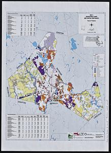
Town of Taunton [land development planning]
10.
The 100th anniversary map of Abraham Lincoln's visit to Massachusetts, September 11-23, 1848
11.
1630 shoreline
12.
1879. Progress map of the U.S. Geographical Surveys west of the 100th Meridian : prepared under the direction of 1st Lieut....
13.
1903 Map of Salem and surrounding places
14.
19th annual convention of the National Association of Real Estate Boards : at Tulsa, June 7 to June 11 in 1926
15.
2005 significant U.S. hurricane strikes
16.
The 2100 project : an atlas for the Green New Deal
17.
227 Harzgerode
18.
305 Glatz
19.
38,000,000 escaped -- 10,000,000 died
20.
4 Kinten
‹ Prev
Next ›
1
2
3
4
5
…
432
433


![Town of Plymouth [land development planning]](https://bpldcassets.blob.core.windows.net/derivatives/images/commonwealth:wh24cv585/image_thumbnail_300.jpg)
![Town of Taunton [land development planning]](https://bpldcassets.blob.core.windows.net/derivatives/images/commonwealth:2b88wd603/image_thumbnail_300.jpg)


