Town of Taunton [land development planning]
![Town of Taunton [land development planning]](https://bpldcassets.blob.core.windows.net/derivatives/images/commonwealth:2b88wd603/image_access_800.jpg)
Item Information
- Title:
- Town of Taunton [land development planning]
- Cartographer:
- Applied Geographics, Inc.
- Date:
-
1999
- Format:
-
Maps/Atlases
- Location:
-
Boston Public Library
Norman B. Leventhal Map & Education Center - Collection (local):
-
Applied Geographics, Inc. Records
- Subjects:
-
Taunton (Mass.)--Maps
Zoning--Massachusetts--Taunton--Maps
City planning--Massachusetts--Taunton--Maps
- Places:
-
MassachusettsBristol (county)Taunton
- Extent:
- 3 maps : color ; sheets 39 x 28 cm
- Terms of Use:
-
No known copyright restrictions.
No known restrictions on use.
- Publisher:
-
Boston :
Applied Geographics, Inc.
- Language:
-
English
- Table of Contents:
-
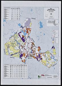
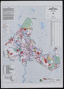
Map 1. Zoning and absolute development constraints
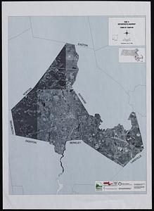
Map 4. Orthophoto basemap
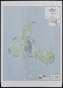
Map 5. Quadrangle basemap.
- Identifier:
-
06_01_019031
- Call #:
-
AppGeo Folder 23
![Town of Plymouth [land development planning]](https://bpldcassets.blob.core.windows.net/derivatives/images/commonwealth:wh24cv585/image_thumbnail_300.jpg)