Developable lands and partial constraints : town of Taunton
Item Information
- Title:
- Developable lands and partial constraints : town of Taunton
- Cartographer:
- Applied Geographics, Inc.
- Contributor:
- MassGIS (Office : Mass.)
- Contributor:
- Massachusetts. Executive Office of Environmental Affairs
- Name on Item:
-
produced by Applied Geographics, Inc.
- Date:
-
1999
- Format:
-
Maps/Atlases
- Genre:
-
Thematic maps
- Location:
-
Boston Public Library
Norman B. Leventhal Map & Education Center - Collection (local):
-
Applied Geographics, Inc. Records
- Subjects:
-
Taunton (Mass.)--Maps
Floods--Massachusetts--Taunton--Maps
Zoning--Massachusetts--Taunton--Maps
Land use--Massachusetts--Taunton--Maps
Real estate development--Massachusetts--Taunton--Maps
- Places:
-
MassachusettsBristol (county)Taunton
- Extent:
- 1 map : color ; 34 x 26 cm
- Terms of Use:
-
No known copyright restrictions.
No known restrictions on use.
- Publisher:
-
Boston :
Applied Geographics, Inc.
- Scale:
-
Scale 1:70,800
- Language:
-
English
- Notes:
-
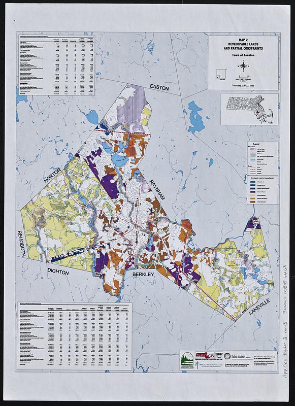
Shows developable land by zoning district.
Also shows flood zones, water features, and roads.
Printed at a smaller size, and scale is smaller than the given statement 1:23243.7
Inset: location map.
Includes summary of commercial and industrial build-out impacts and summary of residential build-out impacts.
- Identifier:
-
06_01_018908
- Call #:
-
AppGeo Folder 3 no. 3
- Barcode:
-
30000008056468
![Town of Plymouth [land development planning]](https://bpldcassets.blob.core.windows.net/derivatives/images/commonwealth:wh24cv585/image_thumbnail_300.jpg)
![Town of Taunton [land development planning]](https://bpldcassets.blob.core.windows.net/derivatives/images/commonwealth:2b88wd603/image_thumbnail_300.jpg)


