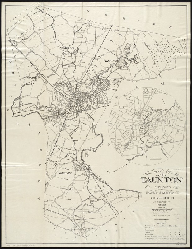
Map of Taunton
Item Information
- Title:
- Map of Taunton
- Creator:
- Sampson, Murdock & Co
- Name on Item:
-
drawn by Luther Dean, C.E.
- Date:
-
[ca. 1916]
- Format:
-
Maps/Atlases
- Location:
-
Boston Public Library
Norman B. Leventhal Map & Education Center - Collection (local):
-
Norman B. Leventhal Map & Education Center Collection
- Subjects:
-
Taunton (Mass.)--Maps
- Places:
-
MassachusettsBristol (county)Taunton
- Extent:
- 1 map ; 84 x 64 cm.
- Terms of Use:
-
No known copyright restrictions.
No known restrictions on use.
- Publisher:
-
Boston :
Sampson, Murdock & Co.
- Scale:
-
Scale [1:23,040].
- Language:
-
English
- Notes:
-
Oriented with north toward the upper right.
Inset: [Taunton and vicinity].
"For 1917."
Distance from city center shown by cocentric circles at half mile intervals.
Shows ward divisions.
- Identifier:
-
06_01_008333
- Call #:
-
G3764.T2 1917 .S2x
- Barcode:
-
39999059014595