Toggle navigation
LMEC Home
Exhibitions
Georeferencing
Tools for Teachers
Collections
My Favorites
Sign Up / Log In
Search
Search the map portal
Map Collection
Map Collection
Map Sets
Search
Search
Search for
Search In
All Fields
Creator
Title
Subject
Place
Search All Digital Collections
Advanced Search
8945 Results
My Search
Start Over
More Like
commonwealth:wd3768095
Remove constraint More Like: commonwealth:wd3768095
Filter your Search
Place
North and Central America
6,176
United States
5,080
Massachusetts
2,216
Europe
1,396
Suffolk (county)
1,210
Boston
1,183
Canada
450
Asia
438
more
Place
»
Topic
Boston (Mass.)--Maps
752
United States--Maps
282
Massachusetts--Maps
235
Real property--Massachusetts--Boston--Maps
195
City planning--Massachusetts--Boston--Maps
158
Landowners--Massachusetts--Boston--Maps
142
New England--Maps
106
North America--Maps--Early works to 1800
103
more
Topic
»
Date
Date range begin
–
Date range end
Current results range from
1482
to
2023
View distribution
Creator
United States. Hydrographic Office
595
Boston Redevelopment Authority
162
O.H. Bailey & Co
148
Des Barres, Joseph F. W. (Joseph Frederick Wallet), 1722-1824
124
United States. Post Office Dept
120
Ptolemy, 2nd cent
100
Walling, Henry Francis, 1825-1888
95
Geological Survey (U.S.)
92
more
Creator
»
Format
Maps/Atlases
8,884
Manuscripts
217
Prints
56
Books
36
Objects/Artifacts
10
Drawings/Illustrations
8
Posters
6
Ephemera
1
Georeferenced
Yes
894
No
8,051
Collection
Norman B. Leventhal Map & Education Center Collection
8,772
Boston and New England Maps
2,411
Urban Maps
2,143
Maritime Charts and Atlases
1,087
American Revolutionary War-Era Maps
662
Boston Redevelopment Authority Collection
195
Mapping Boston Collection
29
William L. Clements Library Collection
23
more
Collection
»
Available to use
No known restrictions
8,708
Creative Commons license
80
Search Constraints
Sort by relevance
relevance
title
date (asc)
date (desc)
Number of results to display per page
20 per page
10
per page
20
per page
50
per page
100
per page
View results as:
grid view
map view
Search Results
2281.
Chart of the coast of America from St. Hellens Sound [to] St. Johns River
2282.
Chart of the coast of America from the Nd. of St. Augustin to Ayes Inlet
2283.
A chart of the Coast of America from Wood Island to Good Harbour from Hollands surveys
2284.
A chart of the coast of America from Wood Island to Good Harbour from Hollands surveys
2285.
A chart of the Coast of America from Wood Island to Good Harbour from Hollands surveys
2286.
Chart of the coast of America thro' the Gulph of Florida
2287.
Chart of the coast of America through the Gulph of Florida to the entrance of the Gulph of Mexico
2288.
A chart of the coast of Barbaria with the western, Canaria, & Cape de Verd, isles
2289.
Chart of the coast of China and of the Japan islands : including the Marianes and part of the Philippines
2290.
Chart of the coast of China, from the Canton River, to the Yang Tze Keang
2291.
A chart of the coast of Maine
2292.
A chart of the coast of New England, from Beverly to Scituate harbour, including the ports of Boston and Salem
2293.
A chart of the coast of New England from the South Shoal to Cape Sable including Georges Bay from Holland & actual surveys
2294.
A chart of the coast of New England from the South Shoal to Cape Sable including Georges Bay from Holland & actual surveys
2295.
A chart of the coast of New York, New Jersey, Pensilvania, Maryland, Virginia, North Carolina, &c
2296.
[Chart of the coast of Quebec from the Riviere St. Jean to Grand Hermine Bay]
2297.
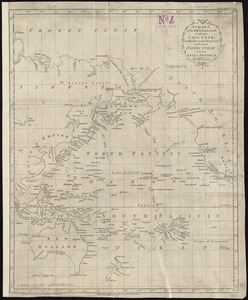
A chart of the discoveries made by the late Capt. Cook, & other European navigators, in the great Pacific Ocean between Asia...
2298.
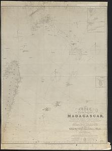
Chart of the east coast of Madagascar, including the Mauritius, Seychelle islands &c. between the latitudes of 2°30' & 26°30'...
2299.
Chart of the entrance of Hudson's River, from Sandy Hook to New York, with the banks, depths of water, sailing-marks, & ca
2300.
[Chart of the gulf and river of St. Lawrence]
‹ Prev
Next ›
1
2
…
111
112
113
114
115
116
117
118
119
…
447
448
![Chart of the coast of America from St. Hellens Sound [to] St. Johns River](https://bpldcassets.blob.core.windows.net/derivatives/images/commonwealth:cj82m727j/image_thumbnail_300.jpg)


![[Chart of the coast of Quebec from the Riviere St. Jean to Grand Hermine Bay]](https://bpldcassets.blob.core.windows.net/derivatives/images/commonwealth:7h149v50v/image_thumbnail_300.jpg)

![[Chart of the gulf and river of St. Lawrence]](https://bpldcassets.blob.core.windows.net/derivatives/images/commonwealth:7h149v39v/image_thumbnail_300.jpg)