Toggle navigation
LMEC Home
Exhibitions
Georeferencing
Tools for Teachers
Collections
My Favorites
Sign Up / Log In
Search
Search the map portal
Map Collection
Map Collection
Map Sets
Search
Search
Search for
Search In
All Fields
Creator
Title
Subject
Place
Search All Digital Collections
Advanced Search
99 Results
My Search
Start Over
More Like
commonwealth:q524n595p
Remove constraint More Like: commonwealth:q524n595p
Filter your Search
Place
World
80
North and Central America
14
United States
9
Adams (county)
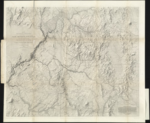
7
Gettysburg National Military Park
6
Pennsylvania
3
New England
2
Arizona
1
more
Place
»
Topic
World maps
82
Pictorial maps
8
Manuscript maps
6
Population--Maps
5
Map projection
4
Telegraph lines--Maps
4
Gettysburg (Pa.)--Maps
3
Gettysburg, Battle of, Gettysburg, Pa., 1863
3
more
Topic
»
Date
Date range begin
–
Date range end
Current results range from
1482
to
2022
View distribution
Creator
Chase, Ernest Dudley, 1878-
7
Bachelder, John B. (John Badger), 1825-1894
4
ODT, Inc
4
Bien, Julius, 1826-1909
3
Brady, Mathew B., approximately 1823-1896
3
Endicott & Co. (New York, N.Y.)
3
Neumann, Louis E.
3
Carey, Mathew, 1760-1839
2
more
Creator
»
Format
Maps/Atlases
94
Manuscripts
8
Photographs
3
Books
1
Documents
1
Georeferenced
Yes
3
No
96
Collection
Norman B. Leventhal Map Center Collection
97
American Revolutionary War-Era Maps
5
Boston and New England Maps
2
Sidney R. Knafel Map Collection at Phillips Academy
2
Urban Maps
1
Available to use
No known restrictions
84
Creative Commons license
4
Search Constraints
Sort by date (asc)
relevance
title
date (asc)
date (desc)
Number of results to display per page
50 per page
10
per page
20
per page
50
per page
100
per page
View results as:
grid view
map view
Search Results
1.
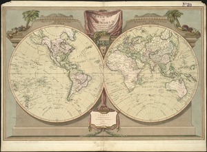
The world
2.
The world
3.
Circular world map
4.
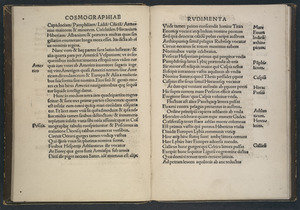
Cosmographiae introductio
5.
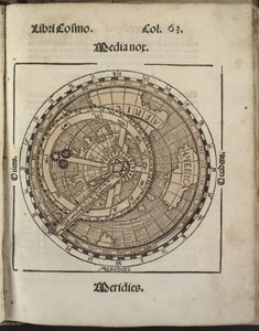
Small circular world map
6.
Typus orbis terrarum
7.
The south part of New England as it planted this yeare, 1634
8.
A map of New-England, being the first that ever was here cut, and done by the best pattern that could be had, which being in...
9.
A new map of the world according to Wrights alias Mercators projection &c : drawn from the newest and the most exact...
10.
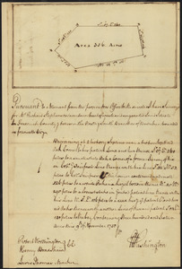
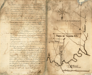
Survey of land for Richard Stephenson in Frederick County; attested by Robert Worthington, Henry Bradshaw and Lewis Thomas : verso
11.
Survey of land for Richard Stephenson in Frederick County; attested by Robert Worthington, Henry Bradshaw and Lewis Thomas : recto
12.
Survey plat of land grants on Caps River, Saint Domingue
13.
Map of American camp in New Jersey and surrounding countryside
14.
[World map]
15.
Map of the world, shewing the tracks & discoveries of Captn. Cook
16.
A chart of the world, according to Mercators projection, shewing the latest discoveries of Capt. Cook
17.
A map of the world from the best authorities
18.
Typo de la carta cosmographica de Gaspar Vopellio Medeburgense
19.
The World
20.
Orbis veteribus notus scilicet: Europe, Asia, Africa publici juris factus
21.
A new map of the world, with Captain Cook's tracks, his discoveries and those of the other circumnavigators
22.
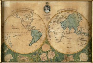
A map of the world
23.
Comparative view of the heights of the principal mountains &c. in the world
24.
The world
25.
Chart of the world, on Mercator's projection : illustrative of the impolicy of slavery
26.
Map of the world
27.
Mappemonde projetée sur l'horizon d'Angers
28.
The World, on the globular projection with a graduation for the measurement of distances especially adapted for the use oe...
29.
[Map of the world]
30.
Map of the world, on Mercator's projection
31.
[Map of the world on a polyconic projection]
32.
[Universal map of China]
33.
The world, on Mercator's projection : showing the different routes to California, and distance by each; routes of different...
34.
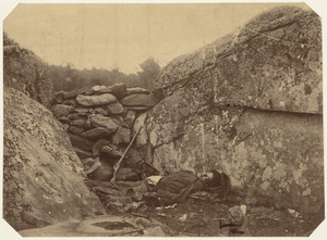
Dead rebel sharpshooter at Gettysburg
35.
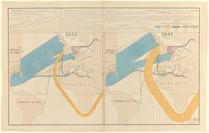
Carte figurative et approximative des quantités de coton en laine importées en Europe en 1858 et en 1861
36.
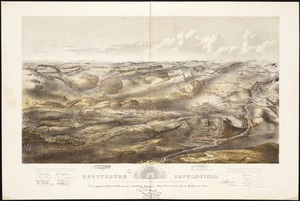
Gettysburg battle-field : Battle fought at Gettysburg, Pa., July 1st, 2d & 3d, 1863 by the Federal and Confederate armies,...
37.
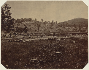
Little Round Top, Gettysburg, July 1863
38.
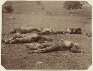
Union dead at Gettysburg
39.
Map of explorations and surveys in New Mexico and Utah made under the direction of the Secretary of War by Capt. J. N. Macomb...
40.
P. McD. Collins' proposed overland telegraph : via Behrings Strait and asiatic Russia to Europe, under Russian & British grants
41.
Chikyū bankoku hōzu
42.
Map of Boston and adjacent country showing that city to be the geographical as well as intellectual and moral centre of one...
43.
Map showing the telegraph lines in operation, under contract, and contemplated, to complete the circuit of the globe
44.
Map showing the telegraph lines in operation, under contract, and contemplated, to complete the circuit of the globe
45.
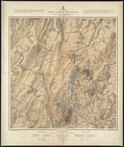
Map of the battle field of Gettysburg, July 1st, 2nd, 3rd, 1863 : Second day's battle
46.
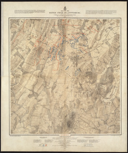
Map of the battle field of Gettysburg, July 1st, 2nd, 3rd, 1863 : First day's battle
47.
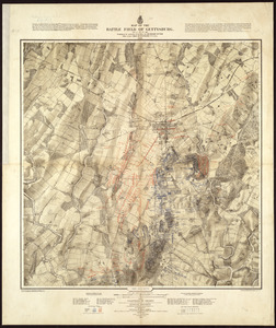
Map of the battle field of Gettysburg, July 1st, 2nd, 3rd, 1863 : Third day's battle
48.
[Mid]dleton's [pione]er map of the [w]orld, [as a?] plane and immoveable
49.
Diqiu quan tu
50.
Magnetic variation chart for the year 1882
‹ Prev
Next ›
1
2


![[World map]](https://bpldcassets.blob.core.windows.net/derivatives/images/commonwealth:x059cd25x/image_thumbnail_300.jpg)


![The World, on the globular projection with a graduation for the measurement of distances especially adapted for the use oe [sic] schools, geographical & historical lectures, and missionary meetings](https://bpldcassets.blob.core.windows.net/derivatives/images/commonwealth:ww72bp12b/image_thumbnail_300.jpg)
![[Map of the world]](https://bpldcassets.blob.core.windows.net/derivatives/images/commonwealth:79408320r/image_thumbnail_300.jpg)

![[Map of the world on a polyconic projection]](https://bpldcassets.blob.core.windows.net/derivatives/images/commonwealth:x633f979b/image_thumbnail_300.jpg)
![[Universal map of China]](https://bpldcassets.blob.core.windows.net/derivatives/images/commonwealth:qb98n8079/image_thumbnail_300.jpg)


![[Mid]dleton's [pione]er map of the [w]orld, [as a?] plane and immoveable](https://bpldcassets.blob.core.windows.net/derivatives/images/commonwealth:7h149v84p/image_thumbnail_300.jpg)

