Chart of the world, on Mercator's projection : illustrative of the impolicy of slavery
Item Information
- Title:
- Chart of the world, on Mercator's projection : illustrative of the impolicy of slavery
- Description:
-
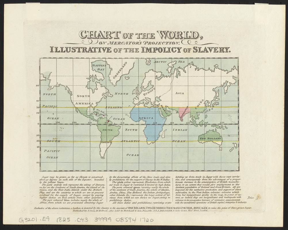
Map showing sugar producing areas where slave labor is used, contrasted with sugar producing areas with which trade is restricted or prohibited because of high duties which protect the sugar of the slave economy. Produced by James Cropper, as an economic argument for the abolition of slavery in the British Empire. Originally published in the Liverpool Mercury in 1823, and published in various other publications through 1828.
- Cartographer:
- Cropper, James, 1773-1840
- Publisher:
- Cross, Joseph
- Date:
-
[ca. 1825]
- Format:
-
Maps/Atlases
- Location:
-
Boston Public Library
Norman B. Leventhal Map & Education Center - Collection (local):
-
Norman B. Leventhal Map & Education Center Collection
- Subjects:
-
Slavery--Maps
Sugar growing--Maps
World maps
- Places:
-
World
- Extent:
- 1 map : hand color ; 11 x 19 cm, on sheet 21 x 26 cm
- Terms of Use:
-
No known copyright restrictions.
No known restrictions on use.
- Publisher:
-
London :
J. Cross
- Scale:
-
Scale approximately 1:1,400,000 at the equator
- Projection:
- Mercator's projection
- Language:
-
English
- Notes:
-
Date of publication estimated from "J. Whatman" watermark.
Includes explanatory text below map.
- Notes (citation):
-
PJ Mode Collection
- Identifier:
-
06_01_016071
- Call #:
-
G3201.E9 1825 .C43
- Barcode:
-
39999085941720


