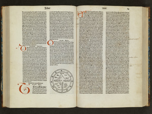
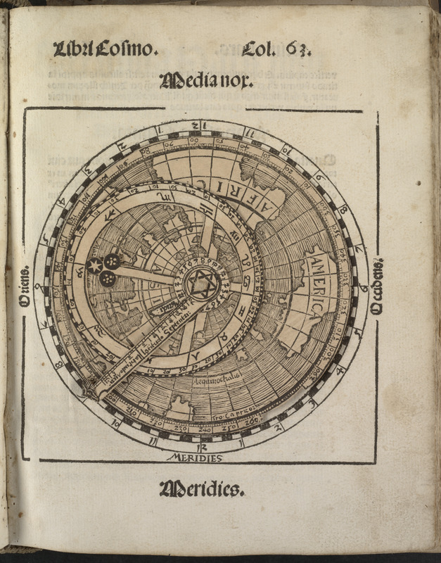
Small circular world map
Item Information
- Title:
- Small circular world map
- Description:
-
Apian, a noted German mathematician, astronomer and geographer, compiled several geographical publications during the first half of the 16th century. His work displayed various iterations of the American continent as originally depicted in Martin Waldseemüller's 1507 world map. A small and generalized version was the circular world map which was included in his astronomical and geographical text book, ''Cosmographicus Liber'', first published in 1524. Using a stereographic projection centered on the North Pole, this circular map shows only the outlines of the known continents -- Europe, Asia, Africa and America. The shape of the latter appears to be patterned after Waldseemüller's America. Since Apian's popular text book was reissued in numerous editions over the next eighty years, this generalized diagram of the continents certainly had a wide influence in spreading a new world view that encompassed four continents
- Cartographer:
- Apian, Peter, 1495-1552
- Date:
-
[1524]
- Format:
-
Maps/Atlases
- Location:
-
Boston Public Library
Rare Books Department - Collection (local):
-
Special Collections, Rare Books
- Subjects:
-
World maps
- Places:
-
World
- Extent:
- 1 map : color ; 36 x 22 cm
- Terms of Use:
-
No known copyright restrictions.
No known restrictions on use.
- Publisher:
-
Excusum Landshutae :
Typis ac formulis d. Ioannis Weyssenburgers, impensis Petri Apiani
- Language:
-
Latin
- Notes:
-
In Cosmographicus liber a Petro Apiano mathematico studiose collectus.
- Notes (date):
-
This date is inferred.
- Notes (citation):
-
NUC pre-1956, NA0354491 (variant issue)
Ortroy, F. van. Bibliographie l'oeuvre de Pierre Apian, no. 23
Stillwell, M.B. Science, II, no. 136 (variant issue)
Zinner, E. Astronomischen Literatur, 1230 (variant issue)
- Notes (exhibitions):
-
Exhibited: "Journeys of the Imagination" organized by the Norman B. Leventhal Map Center at the Boston Public Library, 2006.
- Identifier:
-
05_01_000245
- Barcode:
-
39999081177451