Toggle navigation
LMEC Home
Exhibitions
Georeferencing
Tools for Teachers
Collections
My Favorites
Sign Up / Log In
Search
Search the map portal
Map Collection
Map Collection
Map Sets
Search
Search
Search for
Search In
All Fields
Creator
Title
Subject
Place
Search All Digital Collections
Advanced Search
8563 Results
My Search
Start Over
More Like
commonwealth:kk91fq60v
Remove constraint More Like: commonwealth:kk91fq60v
Date facet yearly ssim
1835
to
1839
Remove constraint Date facet yearly ssim: <span class='from'>1835</span> to <span class='to'>1839</span>
Filter your Search
Place
North and Central America
5,856
United States
4,776
Massachusetts
2,052
Europe
1,359
Suffolk (county)
1,034
Boston
1,007
Canada
450
Asia
422
more
Place
»
Topic
Boston (Mass.)--Maps
577
United States--Maps
273
Real property--Massachusetts--Boston--Maps
174
Massachusetts--Maps
160
Landowners--Massachusetts--Boston--Maps
132
North America--Maps--Early works to 1800
103
New England--Maps
99
Europe--Maps
78
more
Topic
»
Date
Date range begin
–
Date range end
Current results range from
1482
to
2023
View distribution
Creator
United States. Hydrographic Office
594
O.H. Bailey & Co
148
Des Barres, Joseph F. W. (Joseph Frederick Wallet), 1722-1824
124
United States. Post Office Dept
120
Ptolemy, 2nd cent
100
Walling, Henry Francis, 1825-1888
94
Geological Survey (U.S.)
86
Jefferys, Thomas, -1771
86
more
Creator
»
Format
Maps/Atlases
8,504
Manuscripts
215
Prints
56
Books
36
Objects/Artifacts
10
Drawings/Illustrations
8
Posters
4
Georeferenced
Yes
869
No
7,694
Collection
Norman B. Leventhal Map & Education Center Collection
8,555
Boston and New England Maps
2,205
Urban Maps
1,936
Maritime Charts and Atlases
1,085
American Revolutionary War-Era Maps
624
Boston Redevelopment Authority Collection
87
Mapping Boston Collection
6
Richard H. Brown Revolutionary War Map Collection at Mount Vernon
5
more
Collection
»
Available to use
No known restrictions
8,408
Creative Commons license
58
Search Constraints
Sort by date (asc)
relevance
title
date (asc)
date (desc)
Number of results to display per page
100 per page
10
per page
20
per page
50
per page
100
per page
View results as:
grid view
map view
Search Results
401.
Americae nova tabula
402.
Asia noviter delineata
403.
Imperii Sinarum nova descriptio
404.
Virginia
405.
Atrebates : Evesché d'Arras comté d'Artois subdivisé en toutes ses Iurisdictions scav. gouvernance d'Arras, com.te de St Pol...
406.
Le Canada, ou Nouvelle France, &c : ce qui est le plus advance vers le Septentrion est tiré de diverses relations des Anglois,...
407.
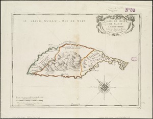
Carte de lisle de Sainct Christophle : scituée a 17 degrez 30 minutes de lat. septentrionale
408.
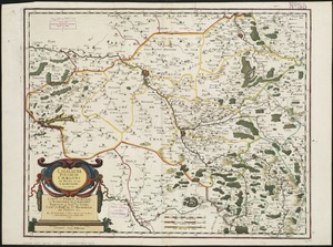
Catalauni : evesché de Chalons sur Marne, et en Champagne
409.
Le Chili
410.
Isle de la Guadeloupe
411.
L'isle de la Martinique : scituée a 14 degrez 30 minutes de latitude septentrionale
412.
Les isles Antilles &c. entre lesquelles sont les Lucayes, et les Caribes
413.
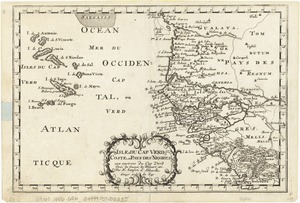
Isles de Cap Verd coste, et pays des Negres
414.
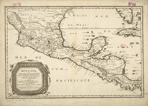
Mexicque, ou Nouvelle Espagne, Nouvlle. Gallice, Iucatan &c : et autres provinces jusques a l'Isthme de Panama, ou sont les...
415.
A new and accurat map of the world drawne according to ye truest descriptions latest discoveries & best observations yt have...
416.
Le Nouveau Mexique et la Floride : tirées de diverses cartes, et relations
417.
Novi Belgii Novaeqve Angliae nec non partis Virginiae Tabula
418.
Oromansaci, et Gesoriacus Pagus in Morinis : evesché de Boulogne ou sont les Comté et seneschaussée de Boulenois : Balliage...
419.
Le Paraguayr, Le Chili, La Terre, et les Isles Magellanicques : tirées de diverses rélations
420.
Partie de Terre Ferme ou sont Guiane et Caribane
421.
Le Perou : et le cours de la rivière Amazone, depuis ses sources jusques à la mer
422.
Terre ferme ou sont les governations ou gouvernemens de Terre ferme, Cartagene Ste. Marthe, Rio de la Hache, Venezuela,...
423.
Insula Borneo et occidentalis pars Celebris, cum adjacentibus insulis
424.
Insulae Iavae, cum parte insularum Borneo Sumatrae, et circumjacentum insularum novissima delineatio
425.
A new, plaine & exact map of Europe : described by N.I. Visscher and done into English, enlarged & corrected according to I....
426.
A new, plaine, & exact mapp of Africa : described by N.I. Visscher and done into English, enlarged and corrected, according to...
427.
A new, plaine, and exact map of America : described by N.I. Visscher, and don into English, enlarged, and corrected, according...
428.
A new, plaine, and exact map of Asia : described by N.I. Visscher, and done into English, enlarged, and corrected, according to...
429.
Americae sive Indiae Occidentalis : tabula generalis
430.
Lugdunensis Prima, cujus metropolis Lugdunum Segusianorum : Province de Lyon ou sont les dioeceses de l'Archevesche de Lyon, et...
431.
Macedonia, Epirus et Achaia
432.
Morea olim Peloponnesus
433.
Segusiani : partie du dioecese et archevesche de Lyon : Le Bas Forez et Beaujolois : eslectons de Roanne et de Villefranche
434.
West-Indische paskaert : waer in de graden der breedde over weder zyden vande middellyn wassende soo vergroten dat die...
435.
[Alleen de Caribische Eilanden, vervat in 't groot]
436.
Americae
437.
Asiae nova
438.
De cust van Barbaria, Gualata, Arguyn en Geneheo van Capo S Vincente tot Capo Verde
439.
Diocese du Mans divisee par doyennes ruraux
440.
Diocese, prevoste, et eslection de Paris : le diocese est divisé en archipretrés, ou doyennés ruraux, la prevosté en...
441.
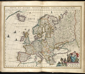
Europae
442.
Insubres in Segusianis : partie du dioecese et archevche de Lyon : partie septentrionale de Bresse, Bugey, et Valromey,...
443.
Meldi : evesché de Meaux : eslections de Meaux de Colomiers et de Rosoy en Brie
444.
Noua et accurata totius Americae tabula
445.
Noui Belgii Nouaeque Angliae nec non partis Virginiae tabula
446.
Nova Africa
447.
Nova totius terrarum orbis tabula
448.
Nova totivs Americae descriptio
449.
Pas caert van Nieu Nederland, Virginia en Nieu Engelant
450.
Pascaart vertoonende de zeecusten van Chili, Peru, Hispania Nova, Nova Granada en California
451.
Pascaerte van Brazil en Nieu Nederlandt, van Corvo en Flores tot de Barbados
452.
Paskaarte van't zuÿdelÿckste Deel van America, van Cabo St. Antonio, to Caep de Hoorn, en de inde Zuÿd Zee, tot B. de Tongoÿ
453.
Paskaert van Brasilia van Pernambuco tot C. de S. Antonio
454.
Tabula Islandiae
455.
Pascaarte vande vaste cust en eylanden van Westindien, als mede de Virginis en Nieu-Nederland, van C. Droge tot C. Cod
456.
Pascaerte van 't westelyckste deel vande Spaense Zee, tuschen Brasil, de zoute en Vlaemse eylanded, en voorwestwart
457.
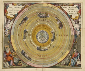
Planisphaerium Ptolemaicum siue machina orbium mundi ex hypothesi Ptolemaica in plano disposita
458.
Africae antiquae, et quarundam Europae, Asiaeque adiacentium regionum
459.
Africæ, described, the manners of their habits and buildings, newly done into English
460.
America : with those known parts in that unknowne worlde both people and manner of buildings discribed and inlarged
461.
Asia : with the islands adioyning described, the atire of the people, & townes of importance, all of them newly augmented
462.
Biscaia, Alava, et Guipuscoa Cantabriae veteris partes
463.
Europ, and the cheife cities contayned therin, described; with the habits of most kingdoms now in use
464.
Extrema Americae versus Boream, ubi Terra Nova, Nova Francia, adjacentiaque
465.
Geldria ducatus, et Zutfania comitatus
466.
Insula Gaditana, vulgo Isla de Cadiz
467.
Insula S. Laurentii, vulgo Madagascar
468.
Insulae Promontorii Viridis, Hispanis, Issas Cabo Verde, Belgis, De Soute Eylanden
469.
Mappa aestivarum insularum, alias Barmudas dictarum, ad ostia Mexicani aestuarij jacentium in latitudine graduum 32 minutorum...
470.
Mappa aestivarum insularum, alias Barmudas dictarum, ad ostia Mexicani aestuarij jacentium in latitudine graduum 32 minutorum...
471.
Mappa æstivarum insularum alias Bermudas dictarum, ad ostia Mexicani æstuary iacentium in latitudine graduum 32 minutorum 25 ab...
472.
Marca d'Ancona olim Picenum
473.
A new and accurat map of the world : drawne according to ye truest descriptions latest discoveries & best observations yt have...
474.
Nigritarum regio
475.
La souverainete de Dombes
476.
Tabula Indiae orientalis
477.
Terra di Lavoro, olim Campania felix
478.
Transisalania provincia : vulgo Over-Yssel
479.
Vmbria overo ducato di Spoleto
480.
Huquang, Kiangsi, Che Kiang, ac Fokien : provin: sivae praefecture Regni Sinen:s, versus Vulturnum, in plaga inter Orientem ac...
481.
Syriae sive Soriae : nova et accurata descriptio
482.
Americae
483.
Foederatae Belgicae tabula : in multis locis emendata et in lucem
484.
Greece with part of Anatolia = La Graecia con parte della Natolia
485.
Mappa fluxus et refluxus rationes in isthmo Americano, in Freto Magellanico, cæterisque Americæ litoribus exhibens
486.
Nieuwe en perfeckte caerte van Engelandt Schotlandt en Yerlandt nieuwelyck vyt gegeven
487.
Pas-kaart van Europa met een gedeelte van de kust van Africa tot aen Cabo Verde
488.
Ducatus Holsatiae, summa diligentia accurataque censura noviter
489.
Pascaerte vande Vlaemsche, Soute, en Caribesche Eylanden, als mede Terra Nova, en de custen van Nova Francia, Nova Anglia, Nieu...
490.
[Polus Antarcticus] : Terra Australis Incognita
491.
Tabula ducatus Brabantiae continens Marchionatum sacri imperii et dominium Mechliniense
492.
Bellovaci et Silvanectes : les Eveschés de Beauvais et Senlis : Comté et Pairrie de Beauvais : Les Balliages de Beauvais,...
493.
Insulae Americanae in Oceano Septentrionali cum terris adiacentibus
494.
Carte de la Russie en Europe : pour servir al'Introduction a l'histoire universelle du Baron de Pufendorf
495.
A new and most exact map of Europe described by N.I. Visscher and don into English and corrected according to I Bleau and...
496.
Pas caerte van Groenland, Ysland, Straet Davids en Ian Mayen eyland hoemen de selvige van Hitland en de noort kusten van...
497.
Systema ideale quo exprimitur, aquarum per canales hydragogos subterraneos ex mari et in montium hydrophylacia protrusio,...
498.
Pas-caert van Terra Nova, Nova Francia, Nieuw-Engeland en de groote rivier van Canada
499.
Paskaert van de Noordelijckste kuste van America van Groenland door de Straet Davis en de Straet Hudson tot Terra Neuf
500.
Plat map for Mount Wollaston Farm, Braintree, Massachusetts-Bay Colony
‹ Prev
Next ›
1
2
3
4
5
6
7
8
9
…
85
86


![[Alleen de Caribische Eilanden, vervat in 't groot]](https://bpldcassets.blob.core.windows.net/derivatives/images/commonwealth:st74cw59p/image_thumbnail_300.jpg)


![[Polus Antarcticus]](https://bpldcassets.blob.core.windows.net/derivatives/images/commonwealth:7h14b184w/image_thumbnail_300.jpg)


![Systema ideale quo exprimitur, aquarum per canales hydragogos subterraneos ex mari et in montium hydrophylacia protrusio, aquarumq[ue] subterrestrium per pyragogos canales concoctus](https://bpldcassets.blob.core.windows.net/derivatives/images/commonwealth:n8710p89m/image_thumbnail_300.jpg)


