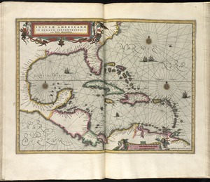
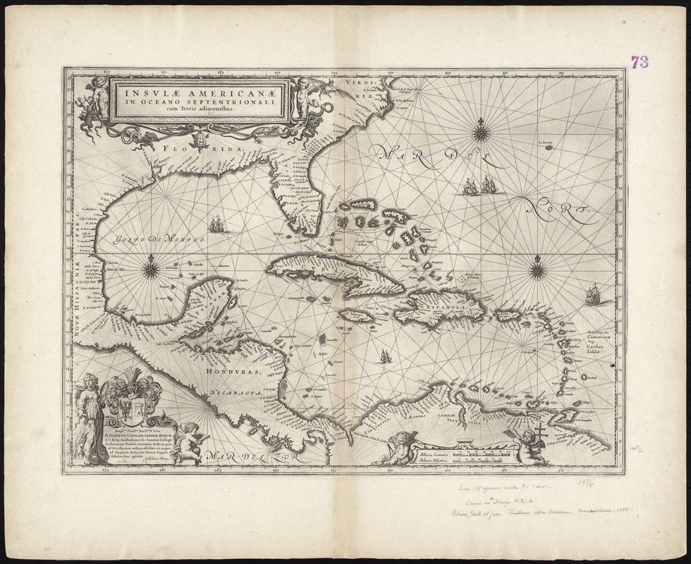
Insulae Americanae in Oceano Septentrionali cum terris adiacentibus
Item Information
- Title:
- Insulae Americanae in Oceano Septentrionali cum terris adiacentibus
- Title (alt.):
-
Collection of old maps
- Creator:
- Blaeu, Willem Janszoon, 1571-1638
- Date:
-
[1667?]
- Format:
-
Maps/Atlases
- Location:
-
Boston Public Library
Norman B. Leventhal Map & Education Center - Collection (local):
-
Norman B. Leventhal Map & Education Center Collection
- Subjects:
-
Coasts--North America--Maps--Early works to 1800
Coasts--South America--Maps--Early works to 1800
Caribbean Area--Maps--Early works to 1800
West Indies--Maps--Early works to 1800
Mexico, Gulf of--Maps--Early works to 1800
- Places:
-
North America (area)
South America
West Indies
Mexico, Gulf of
Caribbean Sea
- Extent:
- 1 map ; 37 x 52 cm.
- Terms of Use:
-
No known copyright restrictions.
No known restrictions on use.
- Publisher:
-
Amsterdam :
s.n.
- Scale:
-
Scale [ca. 1:10,200,000]
- Language:
-
Latin
French
- Notes:
-
Shows southeast coast of North America from Virginia to north coast of South America to east of Trinidad, west coast of Central America, West Indies.
Includes embellished title cartouche, dedication with coats-of-arms, scale and ill. of ships at sea.
Includes scales in milliaria germanica and milliaria hispanica.
Includes dedication to "D. Alberto Conradi Vander Burch" signed "tabulam hanc inscribit Guiljelmus Blaeu."
No text on verso.
Cataloging, conservation, and digitization made possible in part by The National Endowment for the Humanities: Exploring the human endeavor.
Part of composite portfolio atlas with title "Collection of old maps."
- Identifier:
-
06_01_009250
- Call #:
-
G1015 .C65 1630
- Barcode:
-
30000003854329