Toggle navigation
LMEC Home
Exhibitions
Georeferencing
Tools for Teachers
Collections
My Favorites
Sign Up / Log In
Search
Search the map portal
Map Collection
Map Collection
Map Sets
Search
Search
Search for
Search In
All Fields
Creator
Title
Subject
Place
Search All Digital Collections
Advanced Search
8176 Results
My Search
Start Over
More Like
commonwealth:kk91fq60v
Remove constraint More Like: commonwealth:kk91fq60v
Date facet yearly ssim
1843
Remove constraint Date facet yearly ssim: <span class='single'>1843</span>
Filter your Search
Place
North and Central America
4,921
United States
3,605
Suffolk (county)
1,026
Boston
999
Europe
963
Canada
429
France
269
Massachusetts
249
more
Place
»
Topic
Boston (Mass.)--Maps
574
United States--Maps
270
Real property--Massachusetts--Boston--Maps
174
Massachusetts--Maps
160
Landowners--Massachusetts--Boston--Maps
132
North America--Maps--Early works to 1800
103
New England--Maps
99
Europe--Maps
78
more
Topic
»
Date
Date range begin
–
Date range end
Current results range from
1482
to
2023
View distribution
Creator
United States. Hydrographic Office
357
O.H. Bailey & Co
148
Des Barres, Joseph F. W. (Joseph Frederick Wallet), 1722-1824
124
United States. Post Office Dept
120
Ptolemy, 2nd cent
100
Walling, Henry Francis, 1825-1888
94
Jefferys, Thomas, -1771
85
Geological Survey (U.S.)
82
more
Creator
»
Format
Maps/Atlases
8,117
Manuscripts
215
Prints
51
Books
36
Objects/Artifacts
10
Drawings/Illustrations
8
Posters
4
Georeferenced
Yes
869
No
7,307
Collection
Norman B. Leventhal Map Center Collection
8,168
Boston and New England Maps
2,185
Urban Maps
1,925
Maritime Charts and Atlases
754
American Revolutionary War-Era Maps
624
Boston Redevelopment Authority Collection
86
Mapping Boston Collection
6
Richard H. Brown Revolutionary War Map Collection at Mount Vernon
5
more
Collection
»
Available to use
No known restrictions
8,021
Creative Commons license
58
Search Constraints
Sort by relevance
relevance
title
date (asc)
date (desc)
Number of results to display per page
50 per page
10
per page
20
per page
50
per page
100
per page
View results as:
grid view
map view
Search Results
1.
A chart of the sea coast of New Found Land, New Scotland, New England, New York, New Jersey, with Virginia and Maryland
2.
Pascaerte vande Vlaemsche, Soute, en Caribesche Eylanden, als mede Terra Nova, en de custen van Nova Francia, Nova Anglia, Nieu...
3.
The coast of Nova Scotia, New England, New-York, Jersey, the Gulph and River of St. Lawrence : the islands of Newfoundland,...
4.
A chart of the West Indies from Cape Cod to the River Oronoque
5.
A new chart of the coast of New England, Nova Scotia, and the islands of St. Iohn, Cape Breton, Sable, the banks of St. Peters,...
6.
Pascaerte vande Vlaemsche, Soute, en Caribesche Eylanden, als mede Terra Nova, en de custen van Nova Francia, Nova Anglia, Nieu...
7.
Pascaerte van Brazil en Nieu Nederlandt, van Corvo en Flores tot de Barbados
8.
An actual survey of the sea coast from New York to the I. Cape Brition : with tables of the direct and thwart courses &...
9.
A chart of the sea coast of New Foundland, New Scotland, New York, New Jersey, with Virginia and Maryland and New England
10.
De Noordelyckste Zee Kusten van America van Groenland door de Straet Davis ende Straet Hudson tot Terra Neuf =...
11.
Paskaert van de Noordelijckste kuste van America van Groenland door de Straet Davis en de Straet Hudson tot Terra Neuf
12.
The American Pilot [title page]
13.
Pascaerte van Terra Nova Nova Francia Nievw Engeland En de Groote Revier van Canada
14.
Carta particolare della nuoua Belgia è parte della nuoua Anglia
15.
A chart of the coast of New England from the South Shoal to Cape Sable including Georges Bay from Holland & actual surveys
16.
A chart of the coast of New England from the South Shoal to Cape Sable including Georges Bay from Holland & actual surveys
17.
The coast of New England
18.
[Coast of New England from Chatham Harbor to Naragansett Bay]
19.
[Coast of New England from Chatham Harbor to Naragansett Bay]
20.
A correct map of the coast of New England
21.
Pas caerte van Nieu Nederlandt en de Engelsche Virginies van Cabo Cod tot Cabo Canrick
22.
Archipelagus Atlanticus cum suis insulis Canariis, Hesperidibus et Azoribus
23.
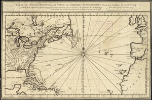
Carte de l'ocean occidental et partie de l'Amerique septentrionale : dressée pour l'intelligence du Journal du voyage que le...
24.
Chart comprizing Greenland with the countries and islands about Baffin's and Hudson's Bays
25.
Chart shewing the tracks across the North Atlantic Ocean of Don Christopher Columbus
26.
Hydrographical map of the Atlantic Ocean, extending from the southermost part of North America to Europe : Shewing the differt....
27.
Mar del nort
28.
A new chart of the Atlantic or Western Ocean
29.
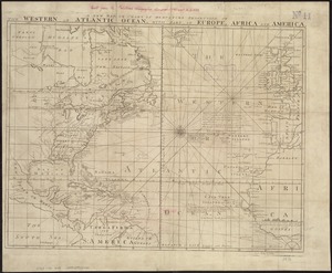
A new map or chart in Mercators projection, of the Western or Atlantic Ocean, with part of Europe, Africa and America
30.
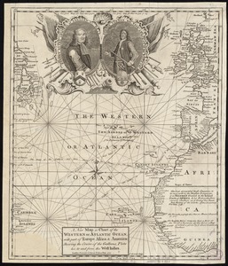
A new map or chart of the Western or Atlantic Ocean, with part of Europe Africa & America : showing the course of galleons,...
31.
Pascaarte vande Noorder Zee custen van America, vande West-hoeck van Ysland doorde Straet Davis en Hudson, tot aen Terra Neuf
32.
Terra nova, ac maris tractus circa Novam Franciam, Angliam, Belgium, Venezuelam Novam, Andalusiam, Guianan, et Brasiliam =...
33.
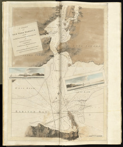
A chart of New York Harbour with the soundings views of land marks and nautical directions : for the use of pilotage
34.
A new and correct chart of the coast of New England and New York with the adjacent parts of Nova Scotia and New Brunswick from...
35.
A map of the coast of New England, from Staten Island to the island of Breton
36.
Chart of the coast of New England
37.
The coast of a part of New England, New York, New Jersey, Pensilvania, Maryland, Virginia, and part of North Carolina &c. with...
38.
The coast of New England
39.
Costes et rivieres de Virginie, de Mariland, et de Nouvelle Angletere
40.
A new chart of the coast of New England, Nova Scotia, and the islands of St. John, Cape Breton, Sable, the banks of St. Peters,...
41.
Carte nouvelle des posséssions angloises en Amérique : dressée pour l'intelligence de la guerre présente et divisée...
42.
Chart comprizing Greenland with the countries and islands about Baffin's and Hudson's Bays
43.
A chart of the Atlantic Ocean : its islands and the adjacent continents: In which the British Dominions in Europe and America,...
44.
A new chart of the vast Atlantic Ocean
45.
The 100th anniversary map of Abraham Lincoln's visit to Massachusetts, September 11-23, 1848
46.
1630 shoreline
47.
1879. Progress map of the U.S. Geographical Surveys west of the 100th Meridian : prepared under the direction of 1st Lieut....
48.
1903 Map of Salem and surrounding places
49.
19th annual convention of the National Association of Real Estate Boards : at Tulsa, June 7 to June 11 in 1926
50.
2005 significant U.S. hurricane strikes
‹ Prev
Next ›
1
2
3
4
5
…
163
164


![The American Pilot [title page]](https://bpldcassets.blob.core.windows.net/derivatives/images/commonwealth:3f462z36r/image_thumbnail_300.jpg)


![[Coast of New England from Chatham Harbor to Naragansett Bay]](https://bpldcassets.blob.core.windows.net/derivatives/images/commonwealth:7h149x27g/image_thumbnail_300.jpg)
![[Coast of New England from Chatham Harbor to Naragansett Bay]](https://bpldcassets.blob.core.windows.net/derivatives/images/commonwealth:7h149z37x/image_thumbnail_300.jpg)