Toggle navigation
LMEC Home
Exhibitions
Georeferencing
Tools for Teachers
Collections
My Favorites
Sign Up / Log In
Search
Search the map portal
Map Collection
Map Collection
Map Sets
Search
Search
Search for
Search In
All Fields
Creator
Title
Subject
Place
Search All Digital Collections
Advanced Search
8585 Results
My Search
Start Over
More Like
commonwealth:ht24zz35n
Remove constraint More Like: commonwealth:ht24zz35n
Filter your Search
Place
North and Central America
5,880
United States
4,804
Massachusetts
2,087
Europe
1,359
Suffolk (county)
1,069
Boston
1,042
Canada
448
Asia
422
more
Place
»
Topic
Boston (Mass.)--Maps
577
United States--Maps
273
Real property--Massachusetts--Boston--Maps
181
Massachusetts--Maps
160
Landowners--Massachusetts--Boston--Maps
132
North America--Maps--Early works to 1800
103
City planning--Massachusetts--Boston--Maps
100
New England--Maps
99
more
Topic
»
Date
Date range begin
–
Date range end
Current results range from
1482
to
2023
View distribution
Creator
United States. Hydrographic Office
594
O.H. Bailey & Co
148
Des Barres, Joseph F. W. (Joseph Frederick Wallet), 1722-1824
123
United States. Post Office Dept
120
Boston Redevelopment Authority
105
Ptolemy, 2nd cent
100
Walling, Henry Francis, 1825-1888
94
Geological Survey (U.S.)
86
more
Creator
»
Format
Maps/Atlases
8,526
Manuscripts
215
Prints
56
Books
36
Objects/Artifacts
10
Drawings/Illustrations
8
Posters
4
Georeferenced
Yes
869
No
7,716
Collection
Norman B. Leventhal Map & Education Center Collection
8,550
Boston and New England Maps
2,239
Urban Maps
1,971
Maritime Charts and Atlases
1,081
American Revolutionary War-Era Maps
616
Boston Redevelopment Authority Collection
122
Available to use
No known restrictions
8,444
Creative Commons license
46
Search Constraints
Sort by relevance
relevance
title
date (asc)
date (desc)
Number of results to display per page
50 per page
10
per page
20
per page
50
per page
100
per page
View results as:
grid view
map view
Search Results
1.
Appleton St. Woonerf
2.
James Hayes Park
3.
Plan accompanying the proposal made to the City of Boston by the Commissioners on Boston Harbor and the Back Bay Octr. 20, 1854...
4.
[Plan of boundary lines in Roxbury and the City of Boston]
5.
Plan of Church St. district, showing estates and buildings : as proposed to be taken by the city of Boston under the Act of the...
6.
Plan of city lands and streets s.w. of Dover St : prepared from new surveys
7.
Plan of estates on Suffolk Street district, belonging to the City of Boston, to be sold at public auction, on Saturday, May 11,...
8.
Plan of house lots & other lands offered for sale by the Boston Water Power Company
9.
Plan of lands belonging to the Boston Water Power Co
10.
Plan of lands belonging to the Boston Water Power Company
11.
Plan of lands belonging to the Boston Water Power Company and the Commonwealth, on the Back Bay, showing part of the city...
12.
[Plan of lots on Falmouth Street, Boston]
13.
Plan of Suffolk Street District : showing estates & buildings as proposed to be taken by the City of Boston under the Act of...
14.
Plan of the estate of the late Warren White : to be sold at public auction on Wednesday March 27th 1872 at 12 o'clock m. on the...
15.
South End urban renewal area project Mass. r-56 : site preparation contract no. 16 street lighting and drainage
16.
A South Ender's view of the world
17.
Union Park
18.
Union Park landscape improvements
19.
View of SoWa food trucks
20.
View of the South End
21.
Washington Street corridor : South Cove to Forest Hills
22.
West Canton Community Park
23.
Fire insurance district atlas : showing the fire insurance districts of the city of Boston : as established by the State...
24.
Insurance map of Boston : volume 2
25.
Insurance map of Boston : volume 2
26.
Insurance map of Boston : volume 1
27.
Insurance map of Boston vol. 3 (South & East Boston)
28.
Insurance map of Charlestown : portions of Roxbury (now annexed to Boston) and Cambridge : 1868 : corrected Nov. 1871
29.
Insurance map of Charlestown : portions of Roxbury (now annexed to Boston) and Cambridge
30.
Insurance maps of Boston volume 4 : comprising portions of Charlestown, East Cambridge, Cambridge Port, Old Cambridge & Somerville
31.
Insurance maps of Boston volume one
32.
Insurance maps of Boston volume two
33.
City of Boston topographic and planimetric survey
34.
Herald Street improvements
35.
Illustrative site plan : a proposal for community review South End/Lower Roxbury development policy
36.
Illustrative site plan : South End urban renewal area, Massachusetts r-56
37.
Illustrative site plan : a proposal for community review South End/Lower Roxbury development policy
38.
Land use New York streets - South Cove 1953
39.
Relationship of TNEMC development plan area to New York streets land assembly and redevelopment project
40.
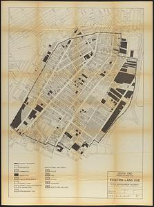
South End project no. Mass. r-56 : existing land use
41.
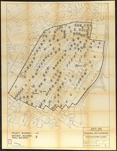
South End project no. Mass. r-56 : building deficiencies
42.
South End renewal area : locality map
43.
South End renewal area : existing conditions & proposed treatment areas
44.
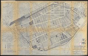
South End renewal area : existing land use
45.
South End urban renewal area project Mass. r-56 site preparation contract no. 50 Worcester Square Park reconstruction
46.
South End urban renewal area R-56 : property map
47.
South End urban renewal area R-56 : property map
48.
South End urban renewal area R-56 : property map
49.
South End urban renewal area R-56 : proposed rights-of-way
50.
South End urban renewal area R-56 : re-use parcels
‹ Prev
Next ›
1
2
3
4
5
…
171
172


![[Plan of boundary lines in Roxbury and the City of Boston]](https://bpldcassets.blob.core.windows.net/derivatives/images/commonwealth:1257bb127/image_thumbnail_300.jpg)


![[Plan of lots on Falmouth Street, Boston]](https://bpldcassets.blob.core.windows.net/derivatives/images/commonwealth:1257bb32q/image_thumbnail_300.jpg)