Toggle navigation
LMEC Home
Exhibitions
Georeferencing
Tools for Teachers
Collections
My Favorites
Sign Up / Log In
Search
Search the map portal
Map Collection
Map Collection
Map Sets
Search
Search
Search for
Search In
All Fields
Creator
Title
Subject
Place
Search All Digital Collections
Advanced Search
570 Results
My Search
Start Over
More Like
commonwealth:gh93ph79k
Remove constraint More Like: commonwealth:gh93ph79k
Filter your Search
Place
North and Central America
467
United States
241
North America
236
Canada
75
New York
26
Asia
19
Pennsylvania
18
Great Lakes Region
15
more
Place
»
Topic
North America--Maps--Early works to 1800
240
United States--Maps--Early works to 1800
55
Canada--Maps--Early works to 1800
49
Great Britain--Colonies--America--Maps--Early works to 1800
18
Central America--Maps--Early works to 1800
14
Great Lakes Region (North America)--Maps--Early works to 1800
14
West Indies--Maps--Early works to 1800
14
New England--Maps--Early works to 1800
11
more
Topic
»
Date
Date range begin
–
Date range end
Current results range from
1528
to
1999
View distribution
Creator
Jefferys, Thomas, -1771
30
Mitchell, John, 1711-1768
22
Sayer, Robert, 1725-1794
21
Gibson, J. (John), active 1750-1792
19
Bellin, Jacques Nicolas, 1703-1772
17
Anville, Jean Baptiste Bourguignon d', 1697-1782
16
Robert Sayer and John Bennett (Firm)
16
Faden, William, 1749-1836
14
more
Creator
»
Format
Maps/Atlases
568
Manuscripts
5
Paintings
3
Ephemera
1
Objects/Artifacts
1
Prints
1
Georeferenced
Yes
5
No
565
Collection
American Revolutionary War-Era Maps
448
MacLean Collection Map Library
379
Norman B. Leventhal Map & Education Center Collection
122
New York Public Library Collection
32
Richard H. Brown Revolutionary War Map Collection at Mount Vernon
18
Mapping Boston Collection
10
Sidney R. Knafel Map Collection at Phillips Academy
8
British Library Collection
3
more
Collection
»
Available to use
No known restrictions
116
Creative Commons license
64
Search Constraints
Sort by relevance
relevance
title
date (asc)
date (desc)
Number of results to display per page
20 per page
10
per page
20
per page
50
per page
100
per page
View results as:
grid view
map view
Search Results
181.
A new and accurate map of North America
182.
A new and accurate map of North America : laid down according to the latest, and most approved observations and discoveries
183.
A new and accurate map of the English empire in North America : representing their rightful claim as confirm'd by charters, and...
184.
A new and accurate map of the English empire in North America : representing their rightful claim as confirm'd by charters, and...
185.
A new and correct map of North America, with the West India Islands : divided according to the last Treaty of Peace, concluded...
186.
A new and correct map of North America with the West India Islands : divided according to the last treaty of peace, concluded...
187.
A new and correct map of North America, with the West India Islands : divided according to the last Treaty of Peace, concluded...
188.
A new and correct map of North America, with the West India islands, divided according to the preliminary articles of peace,...
189.
A New and correct map of the British colonies in North America comprehending eastern Canada with the province of Quebec, New...
190.
A new and exact map of the dominions of the King of Great Britain on ye continent of North America : containing Newfoundland,...
191.
A new and exact map of the dominions of the King of Great Britain on ye continent of North America : containing Newfoundland,...
192.
A new map of North America : with the British, French, Spanish, Dutch & Danish dominions on that great continent, and the West...
193.
A new map of North America
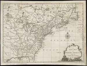
194.
A new map of North America from the latest discoveries
195.
A new map of North America from the latest discoveries
196.
A new map of North America shewing its principal divisions, chief cities, townes, rivers, mountains &c
197.
A new map of North America wherein the British Dominions in the continent of North America : and on the islands of the West...
198.
A New map of North America with the West India Islands : divided according to the preliminary articles of peace, signed at...
199.
A New map of North America with the West India Islands : divided according to the preliminary articles of peace, signed at...
200.
A new map of the British colonies in North America, shewing the seat of the present war, taken from the best surveys, compared...
‹ Prev
Next ›
1
2
…
6
7
8
9
10
11
12
13
14
…
28
29