Toggle navigation
LMEC Home
Exhibitions
Georeferencing
Tools for Teachers
Collections
My Favorites
Sign Up / Log In
Search
Search the map portal
Map Collection
Map Collection
Map Sets
Search
Search
Search for
Search In
All Fields
Creator
Title
Subject
Place
Search All Digital Collections
Advanced Search
14021 Results
Filter your Search
Place
North and Central America
10,683
United States
8,692
Massachusetts
2,808
Suffolk (county)
1,682
Boston
1,638
Europe
1,420
Canada
1,009
New York
674
more
Place
»
Topic
Boston (Mass.)--Maps
748
City planning--Massachusetts--Boston--Maps
418
United States--History--Revolution, 1775-1783--Maps
331
United States--Maps
328
Real property--Massachusetts--Boston--Maps
254
Urban renewal--Massachusetts--Boston--Maps
254
North America--Maps--Early works to 1800
240
Massachusetts--Maps
234
more
Topic
»
Date
Date range begin
–
Date range end
Current results range from
1482
to
2023
View distribution
Creator
United States. Hydrographic Office
597
Boston Redevelopment Authority
404
Des Barres, Joseph F. W. (Joseph Frederick Wallet), 1722-1824
247
Jefferys, Thomas, -1771
172
Royal United Services Institute for Defence and Security Studies
160
George, III, King of Great Britain, 1738-1820
152
George, IV, King of Great Britain, 1762-1830
151
O.H. Bailey & Co
148
more
Creator
»
Format
Maps/Atlases
13,839
Manuscripts
985
Prints
102
Books
49
Drawings/Illustrations
44
Photographs
15
Objects/Artifacts
13
Documents
7
more
Format
»
Georeferenced
Yes
979
No
13,042
Collection
Norman B. Leventhal Map & Education Center Collection
9,110
American Revolutionary War-Era Maps
3,627
Boston and New England Maps
2,921
Urban Maps
2,480
Maritime Charts and Atlases
1,169
William L. Clements Library Collection
910
Library of Congress Collection
618
Boston Redevelopment Authority Collection
475
more
Collection
»
Available to use
No known restrictions
10,268
Creative Commons license
1,678
Search Constraints
Sort by relevance
relevance
title
date (asc)
date (desc)
Number of results to display per page
20 per page
10
per page
20
per page
50
per page
100
per page
View results as:
grid view
map view
Search Results
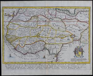
181.
Africa or Libia Ulterior : where are the countries of Saara Desert and the countrie of Negroes and Guine with the circumjacent...
182.
Africa vegetation
183.
Africae antiquae, et quarundam Europae, Asiaeque adiacentium regionum
184.
Africæ, described, the manners of their habits and buildings, newly done into English
185.
Africae nova descriptio
186.
Africae nova tabula
187.
Africae tabula nova
188.
Africa--east coast, coast of Zanzibar, Kiswere Harbor : from a British survey by the officers of H.M.S. Nassau, 1874 :...
189.
Africa--east coast, coast of Zanzibar, Mchinga Bay (Port Nungwa) : from a British survey by the officers of H.M.S. Nassau, 1874...
190.
Africa--east coast, coast of Zanzibar, Mikindani Bay with Mto Mtwara and Mikindani Harbrs : from a British survey by the...
191.
Africa--east coast, harbors on the coast of Zanzibar : from a British survey by the officers of H.M.S. Nassau, 1874 :...
192.
Africa--north coast, Strait of Gibraltar, Tangier Bay : from a French survey in 1855 ; republication of the Brit. Admty. chart...
193.
Afrika
194.
Afrika
195.
Afrika
196.
L'Afrique : dressée, sur les relations les plus recentes, et assujettie aux observations astronomiques
197.
Afrique
198.
Afrique
199.
L'Afrique : dressée sur les relations e nouvelles decouvertes de differens voyageurs, conformes aux observations astronomiques
200.
L'Afrique
‹ Prev
Next ›
1
2
…
6
7
8
9
10
11
12
13
14
…
701
702