Toggle navigation
LMEC Home
Exhibitions
Georeferencing
Tools for Teachers
Collections
My Favorites
Sign Up / Log In
Search
Search the map portal
Map Collection
Map Collection
Map Sets
Search
Search
Search for
Search In
All Fields
Creator
Title
Subject
Place
Search All Digital Collections
Advanced Search
474 Results
My Search
Start Over
More Like
commonwealth:dn403j96s
Remove constraint More Like: commonwealth:dn403j96s
Filter your Search
Place
North and Central America
394
United States
275
Canada
96
North America
86
New York
24
Pennsylvania
19
Asia
17
Great Lakes Region
16
more
Place
»
Topic
United States--Maps--Early works to 1800
103
Canada--Maps--Early works to 1800
79
North America--Maps--Early works to 1800
77
Great Lakes Region (North America)--Maps--Early works to 1800
17
New England--Maps--Early works to 1800
12
Northeastern States--Maps--Early works to 1800
12
Pennsylvania--Maps--Early works to 1800
12
Great Britain--Colonies--America--Maps--Early works to 1800
9
more
Topic
»
Date
Date range begin
–
Date range end
Current results range from
1618
to
1999
View distribution
Creator
Bellin, Jacques Nicolas, 1703-1772
27
Jefferys, Thomas, -1771
20
Robert Sayer and John Bennett (Firm)
19
Faden, William, 1749-1836
16
Gibson, J. (John), active 1750-1792
14
Carleton, Osgood, 1742-1816
13
Bowles, Carington, 1724-1793
11
Mitchell, John, 1711-1768
11
more
Creator
»
Format
Maps/Atlases
472
Manuscripts
5
Paintings
3
Ephemera
1
Objects/Artifacts
1
Prints
1
Georeferenced
Yes
5
No
469
Collection
American Revolutionary War-Era Maps
406
MacLean Collection Map Library
379
Norman B. Leventhal Map & Education Center Collection
46
New York Public Library Collection
17
Richard H. Brown Revolutionary War Map Collection at Mount Vernon
11
Library and Archives Canada Collection
8
New-York Historical Society Collection
4
Mapping Boston Collection
3
more
Collection
»
Available to use
No known restrictions
47
Creative Commons license
36
Search Constraints
Sort by relevance
relevance
title
date (asc)
date (desc)
Number of results to display per page
20 per page
10
per page
20
per page
50
per page
100
per page
View results as:
grid view
map view
Search Results
141.
Charte über die XIII Vereinigte Staaten von Nord-America
142.
A general map of the middle British colonies, in America : viz Virginia, Màriland, Dèlaware, Pensilvania, New-Jersey, New-York,...
143.
A general map of the middle British colonies, in America : viz Virginia, Màriland, Dèlaware, Pensilvania, New-Jersey,...
144.
Map for the interior travels through America : delineating the march of the army
145.
A map of Carolana and of the river Meschacebe &c
146.
A Map of the British American plantations, extending from Boston in New England to Georgia : including all the back settlements...
147.
A map of the northern and middle states : comprehending the western territory & the British dominions in North America : from...
148.
Map of the United States exhibiting the post-roads, the situations, connections & distances of the post-offices, stage roads,...
149.
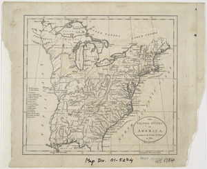
A map of the United States of America, as settled by the peace of 1783
150.
A map of the United States of N. America
151.
A map of the United States of North America : drawn from a number of critical researches
152.
A new and correct map of North America : in which the places of the principal engagements during the present war are accurately...
153.
A new and correct map of North America : in which the places of the principal engagements during the present war are accurately...
154.
A new and correct map of North America with the West India Islands : divided according to the last treaty of peace, concluded...
155.
A new and correct map of North America, with the West India islands, divided according to the preliminary articles of peace,...
156.
Partie de l'Amérique septentrionale, qui comprend le cours de l'Ohio, la Nlle. Angleterre, la Nlle York, le New Jersey, la...
157.
Partie septentrionale des possessions angloise en Amérique : pour servire d'intelligence à la guerre présente entre les...
158.
Schauplatz des Kriegs zwischen Engelland und seinen Collonien in America
159.
States of America, drawn from the best authorities
160.
The United States of America, according to the Treaty of Peace of 1784
‹ Prev
Next ›
1
2
…
4
5
6
7
8
9
10
11
12
…
23
24