Toggle navigation
LMEC Home
Exhibitions
Georeferencing
Tools for Teachers
Collections
My Favorites
Sign Up / Log In
Search
Search the map portal
Map Collection
Map Collection
Map Sets
Search
Search
Search for
Search In
All Fields
Creator
Title
Subject
Place
Search All Digital Collections
Advanced Search
8748 Results
My Search
Start Over
More Like
commonwealth:cj82m243w
Remove constraint More Like: commonwealth:cj82m243w
Filter your Search
Place
North and Central America
5,969
United States
4,884
Massachusetts
2,079
Europe
1,396
Suffolk (county)
1,045
Boston
1,018
Canada
459
Asia
438
more
Place
»
Topic
Boston (Mass.)--Maps
586
United States--Maps
282
Real property--Massachusetts--Boston--Maps
175
Massachusetts--Maps
162
Landowners--Massachusetts--Boston--Maps
133
North America--Maps--Early works to 1800
106
New England--Maps
102
Europe--Maps
79
more
Topic
»
Date
Date range begin
–
Date range end
Current results range from
1482
to
2023
View distribution
Creator
United States. Hydrographic Office
595
O.H. Bailey & Co
148
Des Barres, Joseph F. W. (Joseph Frederick Wallet), 1722-1824
123
United States. Post Office Dept
120
Ptolemy, 2nd cent
100
Walling, Henry Francis, 1825-1888
94
Jefferys, Thomas, -1771
87
Geological Survey (U.S.)
86
more
Creator
»
Format
Maps/Atlases
8,688
Manuscripts
216
Prints
56
Books
36
Objects/Artifacts
10
Drawings/Illustrations
8
Posters
5
Georeferenced
Yes
869
No
7,879
Collection
Norman B. Leventhal Map & Education Center Collection
8,700
Boston and New England Maps
2,232
Urban Maps
2,023
Maritime Charts and Atlases
1,086
American Revolutionary War-Era Maps
662
Boston Redevelopment Authority Collection
87
New York Public Library Collection
13
MacLean Collection Map Library
11
more
Collection
»
Available to use
No known restrictions
8,556
Creative Commons license
82
Search Constraints
Sort by relevance
relevance
title
date (asc)
date (desc)
Number of results to display per page
20 per page
10
per page
20
per page
50
per page
100
per page
View results as:
grid view
map view
Search Results
1.
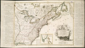
The provinces of New York and New Jersey : with part of Pensilvania, and the Province of Quebec
2.
Boston, its environs and harbour, with the rebel works raised against that town in 1775 : from the observations of Lieut. Page...
3.
Boston with its environs
4.
Bowles's map of the seat of war in New England, comprehending the provinces of Massachusets Bay, and New Hampshire : with the...
5.
Carte des Etats-Unis de l'Amerique suivant le Traité de Paix de 1783
6.
A general map of the southern British colonies in America comprehending North and South Carolina, Georgia, East and West...
7.
Map for the interior travels through America, delineating the march of the army
8.
A new and accurate map of the present seat of war in North America
9.
Partie de l'Amerique Septentrionale, qui comprend le Canada, la Louisiane, le Labrador, le Groenland, la Nouvelle Angleterre,...
10.
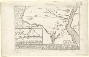
Plan der landung der Gebrüdere Howe, bey dem ausfluss des Elk Strom ...Lords Cornwallis
11.
Plan of the town of Boston, with the attack on Bunkers-Hill, in the peninsula of Charlestown, the 17th of June, 1775
12.
Theatre de la guerre en Amerique
13.
Théatre de la guerre en Amerique, avec les Isles Antilles : projetté et assujettie aux observations
14.
Théatre de la guerre en Amerique, avec les Isles Antilles : projetté et assujettie aux observations
15.
The theatre of war in North America, with the roads, and tables, of the superficial contents, distances, &ca
16.
Carte du théatre de la guerre entre les Anglais et les Américains
17.
A general map of the middle British colonies in America : viz. Virginia, Maryland, Delaware, Pensilvania, New-Jersey, New-York,...
18.
A general map of the middle British colonies in America, viz. Virginia, Maryland, Delaware, Pensilvania, New-Jersey, New York,...
19.
Karte von Neu England, Neu Yorck und Pensilvanien : sur Allgemeinen historie der reisen
20.
A map of the middle British colonies in North America : first published by Mr. Lewis Evans, of Philadelphia, in 1755; and since...
‹ Prev
Next ›
1
2
3
4
5
…
437
438