Toggle navigation
LMEC Home
Exhibitions
Georeferencing
Tools for Teachers
Collections
My Favorites
Sign Up / Log In
Search
Search the map portal
Map Collection
Map Collection
Map Sets
Search
Search
Search for
Search In
All Fields
Creator
Title
Subject
Place
Search All Digital Collections
Advanced Search
8550 Results
My Search
Start Over
More Like
commonwealth:cj82kt05v
Remove constraint More Like: commonwealth:cj82kt05v
Filter your Search
Place
North and Central America
5,845
United States
4,769
Massachusetts
2,052
Europe
1,358
Suffolk (county)
1,034
Boston
1,007
Canada
448
Asia
422
more
Place
»
Topic
Boston (Mass.)--Maps
577
United States--Maps
273
Real property--Massachusetts--Boston--Maps
174
Massachusetts--Maps
160
Landowners--Massachusetts--Boston--Maps
132
North America--Maps--Early works to 1800
103
New England--Maps
99
Europe--Maps
78
more
Topic
»
Date
Date range begin
–
Date range end
Current results range from
1482
to
2023
View distribution
Creator
United States. Hydrographic Office
594
O.H. Bailey & Co
148
Des Barres, Joseph F. W. (Joseph Frederick Wallet), 1722-1824
123
United States. Post Office Dept
120
Ptolemy, 2nd cent
100
Walling, Henry Francis, 1825-1888
94
Geological Survey (U.S.)
86
Jefferys, Thomas, -1771
85
more
Creator
»
Format
Maps/Atlases
8,491
Manuscripts
215
Prints
56
Books
36
Objects/Artifacts
10
Drawings/Illustrations
8
Posters
4
Georeferenced
Yes
869
No
7,681
Collection
Norman B. Leventhal Map & Education Center Collection
8,549
Boston and New England Maps
2,204
Urban Maps
1,936
Maritime Charts and Atlases
1,081
American Revolutionary War-Era Maps
616
Boston Redevelopment Authority Collection
87
Sidney R. Knafel Map Collection at Phillips Academy
1
Available to use
No known restrictions
8,408
Creative Commons license
46
Search Constraints
Sort by relevance
relevance
title
date (asc)
date (desc)
Number of results to display per page
50 per page
10
per page
20
per page
50
per page
100
per page
View results as:
grid view
map view
Search Results
1.
A new map of Denmark and Sweden : according to ye newest and most exact observations
2.
Regni Sueciae tabula generalis, divisa in Sueciae, Gotiaeq[ue] regna Finniae ducatum Lapponiam, Livoniam Ingrianq[ue] et in...
3.
The seat of war in ye North : or a map of the Baltick, with part of the North Sea ... posture of affaris
4.
The seat of war in ye North : or a map of the Baltick, with part of the North Sea ... posture of affaris
5.
Quarta Europe tabula continet Germaniam
6.
Regnum Bohemia, eique annexae provinciae, ut Ducatus Silesia, marchionatus Moravia, et Lusatia : quae sunt terrae Haereditariae...
7.
Regnum Bohemia, eique annexae provinciae ut Ducatus Silesia marchionatus Moravia, et Lusatia quae sunt terrae haereditariae...
8.
Tabula IIII Europae
9.
Scandinavia
10.
[Scandinavia]
11.
Tab. nova Norbegiae et Gottiae
12.
Map of the several countries thro' which the Russians are to pass in their march to Prussia
13.
Marchionatus Brandenburgicus
14.
Regni Poloniae et Ducatus Lithuaniae, Voliniae, Podoliae, Ucraniae, Prussiae, Livoniae et Curlandiae descriptio
15.
Tabu. moderna Hungariae, Poloniae, Russiae, Prussiae et Valachiae
16.
To His Most Serene and August Majesty Peter Alexovitz absolute lord of Russia &c. this map of Moscovy, Poland, Little Tartary,...
17.
Circulus electorum Rheni sive Rhenanus Inferior complectens accuratam descriptionem Archiepiscopatus Moguntini Coloniensis et...
18.
Ducatus Meklenburgicus in quo sunt Ducatus Vandaliae et Meklenburgi Comitatus et Episcopatus Swerinensis Rostochiense et...
19.
Electoratus et Palatinatus Rheni Episcopatuum Spirensis et Wormacensis ducatuum Bipontii et Simmerae et Comitatuum...
20.
Map of the Empire of Germany : including all the states comprehended under that name : with the Kingdom of Prussia, &c
21.
A mapp of the seat of the warrs in Germany and the Spanish Netherlands, for His Majesties own use
22.
A new map of Germanie
23.
A new mapp of the upper part of the Rhine containing all Switzerland the circle of Swabia Alsatia the Palatine of the Rhine...
24.
Quarta Europae tabula
25.
The seat of war on the Rhine being a new map of the course of that river from Basil to Bonn with the adjacent countries
26.
S.R.I. Sueviae Circulus atq[ue] Ducatus una cum insertis et adjacentibus Regionibus, accuratissime in earundem particulares...
27.
Ta. mo. Germa
28.
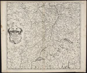
Tabula geographica qua pars meridionalis sive superior Rheni, Mosae, et Mosellae, ac minores in eosdem influentes Fluvii nec...
29.
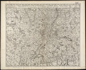
Tabula geographica qua pars septentrionalis sive Inferior Rheni, Mosae, et Mosellae, maximaeque partes Visurgis, Moeni, Amasi,...
30.
The 100th anniversary map of Abraham Lincoln's visit to Massachusetts, September 11-23, 1848
31.
1630 shoreline
32.
1879. Progress map of the U.S. Geographical Surveys west of the 100th Meridian : prepared under the direction of 1st Lieut....
33.
1903 Map of Salem and surrounding places
34.
19th annual convention of the National Association of Real Estate Boards : at Tulsa, June 7 to June 11 in 1926
35.
2005 significant U.S. hurricane strikes
36.
The 2100 project : an atlas for the Green New Deal
37.
227 Harzgerode
38.
305 Glatz
39.
38,000,000 escaped -- 10,000,000 died
40.
4 Kinten
41.
660 Wakulah St., Roxbury
42.
[A chart of Boston Bay and vicinity]
43.
[A chart of New York Island & North River : East River, passage through Hell Gate, Flushing Bay, Hampstead Bay, Oyster,...
44.
The A.A.A. key road map of continental Europe
45.
Aaron Bohrod's America, its history
46.
ABC pathfinder railway guide map : eastern division
47.
Abolition of Slavery, 1863
48.
Aboriginal map of North America, denoting the boundaries and the locations of various Indian tribes
49.
Acapulco, México
50.
Accurata delineatio Castrorum Suecicorum, ut et Haffniae, Regni Daniae Metropolis
‹ Prev
Next ›
1
2
3
4
5
…
170
171
![Regni Sueciae tabula generalis, divisa in Sueciae, Gotiaeq[ue] regna Finniae ducatum Lapponiam, Livoniam Ingrianq[ue] et in omnes subiacentes provincias](https://bpldcassets.blob.core.windows.net/derivatives/images/commonwealth:cj82kt14t/image_thumbnail_300.jpg)


![[Scandinavia]](https://bpldcassets.blob.core.windows.net/derivatives/images/commonwealth:7h14b059b/image_thumbnail_300.jpg)


![S.R.I. Sueviae Circulus atq[ue] Ducatus una cum insertis et adjacentibus Regionibus, accuratissime in earundem particulares provincias divisum](https://bpldcassets.blob.core.windows.net/derivatives/images/commonwealth:cj82kw70k/image_thumbnail_300.jpg)


![[A chart of Boston Bay and vicinity]](https://bpldcassets.blob.core.windows.net/derivatives/images/commonwealth:cj82m2976/image_thumbnail_300.jpg)


