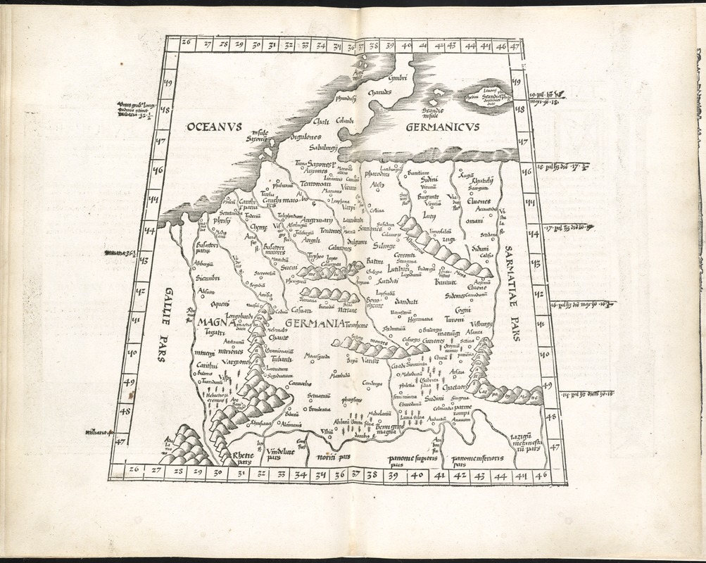
Tabula IIII Europae
Item Information
- Title:
- Tabula IIII Europae
- Title (alt.):
-
Germania magna
- Creator:
- Ptolemy, 2nd cent
- Date:
-
1525
- Format:
-
Maps/Atlases
- Location:
-
Boston Public Library
Norman B. Leventhal Map & Education Center - Collection (local):
-
Norman B. Leventhal Map & Education Center Collection
- Subjects:
-
Germany--Maps--Early works to 1800
Poland--Maps--Early works to 1800
Czech Republic--Maps--Early works to 1800
- Places:
-
Germany
Poland
Czech Republic
- Extent:
- 1 map ; 29 x 30 cm.
- Terms of Use:
-
No known copyright restrictions.
No known restrictions on use.
- Publisher:
-
Argentoragi [i.e. Strasbourg] :
Iohannes Grieningerus
- Scale:
-
Scale [ca. 1:5,300,000]
- Language:
-
Latin
- Notes:
-
Map of ancient Germania, east of the Rhine, and west of the Vistula River, encompassing present day Germany, Poland, and the Czech Republic.
Relief shown pictorially.
Includes names of places and natural features.
In margin: latitudinal notes.
Descriptive text within ornamental borders on verso.
Appears in the author's Geographia, translated by Willibald Pirckheimer, with annotations by Joannes Regiomontanus. Argentoragi [i.e. Strasbourg] : Iohannes Grieningerus, communibus Iohannis Koberger impensis excudebat, anno a Christi Natiuitate 1525 tertio Kal[endas] Apriles.
Text in Latin.
Cataloging, conservation, and digitization made possible in part by The National Endowment for the Humanities: Exploring the human endeavor.
Atlas scanned by Internet Archive http://archive.org/details/claudiiptolemaei00ptol
- Identifier:
-
06_01_007973
- Call #:
-
G1005 .P7 1525
- Barcode:
-
30000003782876