Toggle navigation
LMEC Home
Exhibitions
Georeferencing
Tools for Teachers
Collections
My Favorites
Sign Up / Log In
Search
Search the map portal
Map Collection
Map Collection
Map Sets
Search
Search
Search for
Search In
All Fields
Creator
Title
Subject
Place
Search All Digital Collections
Advanced Search
8172 Results
My Search
Start Over
More Like
commonwealth:9s161f61d
Remove constraint More Like: commonwealth:9s161f61d
Filter your Search
Place
North and Central America
4,921
United States
3,611
Suffolk (county)
1,035
Boston
1,009
Europe
963
Canada
427
France
269
Massachusetts
249
more
Place
»
Topic
Boston (Mass.)--Maps
574
United States--Maps
270
Real property--Massachusetts--Boston--Maps
174
Massachusetts--Maps
160
Landowners--Massachusetts--Boston--Maps
132
North America--Maps--Early works to 1800
103
New England--Maps
99
Europe--Maps
78
more
Topic
»
Date
Date range begin
–
Date range end
Current results range from
1482
to
2023
View distribution
Creator
United States. Hydrographic Office
357
O.H. Bailey & Co
148
Des Barres, Joseph F. W. (Joseph Frederick Wallet), 1722-1824
123
United States. Post Office Dept
120
Ptolemy, 2nd cent
100
Walling, Henry Francis, 1825-1888
94
Jefferys, Thomas, -1771
84
Geological Survey (U.S.)
82
more
Creator
»
Format
Maps/Atlases
8,113
Manuscripts
215
Prints
51
Books
36
Objects/Artifacts
10
Drawings/Illustrations
8
Posters
4
Georeferenced
Yes
869
No
7,303
Collection
Norman B. Leventhal Map Center Collection
8,162
Boston and New England Maps
2,193
Urban Maps
1,934
Maritime Charts and Atlases
750
American Revolutionary War-Era Maps
616
Boston Redevelopment Authority Collection
96
Available to use
No known restrictions
8,031
Creative Commons license
46
Search Constraints
Sort by relevance
relevance
title
date (asc)
date (desc)
Number of results to display per page
50 per page
10
per page
20
per page
50
per page
100
per page
View results as:
grid view
map view
Search Results
1.
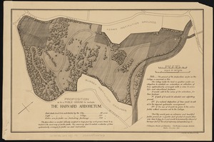
Map of Arnold Arboretum showing location of the trees and shrubs
2.
Map of Arnold Arboretum showing location of the trees and shrubs
3.
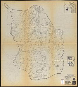
Plan of the Arnold Arboretum Jamaica Plain Mass
4.
Plan of house lots located on Jamaica Plain belonging to the estate of John Dorr, dec'd
5.
Atlas of Dorchester, West Roxbury and Brighton, city of Boston
6.
Atlas of the city of Boston : Roxbury : from actual surveys and official plans
7.
Atlas of the city of Boston : Roxbury : from actual surveys and official plans
8.
Atlas of the city of Boston : Roxbury : from actual surveys and official plans
9.
Atlas of the city of Boston : Roxbury : from actual surveys and official plans
10.
Atlas of the city of Boston : Roxbury : volume two : from actual surveys and official records
11.
Atlas of the city of Boston : Roxbury, Mass. : volume three : from actual surveys and official records
12.
Atlas of the city of Boston : volume 6 : West Roxbury : from actual surveys and official plans
13.
Atlas of the city of Boston : volume 6 : West Roxbury : from actual surveys and official plans
14.
Atlas of the city of Boston : West Roxbury : from actual surveys and official plans
15.
Atlas of the city of Boston : West Roxbury : from actual surveys and official plans
16.
Atlas of the city of Boston : West Roxbury : volume five : from actual surveys and official records
17.
Atlas of the city of Boston, West Roxbury, Mass., volume six : from actual surveys and official plans
18.
Atlas of the county of Suffolk, Massachusetts : vol. 2nd late city of Roxbury, now wards 13-14 and 15, city of Boston
19.
Atlas of the county of Suffolk, Massachusetts : vol. 5th, West Roxbury, now ward 17, Boston : from actual survey & official...
20.
Forest Hills Cemetery : consecrated June 28th, 1848 : area 203 acres
21.
Jamaica Park and Bussey Farm Parkway : West Roxbury district
22.
Jamaica Plain view of the world
23.
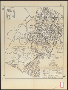
Jamaica Pond master plan
24.
Map of proposed arboretum, showing its outlines and local connections, with a study for public drive passing through it
25.
Olmsted Park master plan
26.
Proposition as to a public ground to include the Harvard Arboretum
27.
Washington Street corridor : South Cove to Forest Hills
28.
Adams Nervine Asylum
29.
Jamaica Plain urban renewal area r-49 : building conditions
30.
Jamaica Plain urban renewal area r-49 : existing population density
31.
Jamaica Plain urban renewal area r-49 : existing and proposed community facilities
32.
Jamaica Plain urban renewal area r-49 : proposed land use
33.
Jamaica Plain urban renewal area r-49 : existing land use
34.
Jamaica Plain urban renewal area r-49 : proposed circulation
35.
Jamaica Plain urban renewal area r-49 : existing circulation
36.
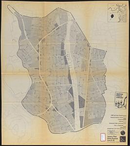
Jamaica Plain urban renewal area r-49 : proposed treatment and title I projects
37.
Zoning districts city of Boston map 9 Jamaica Plain
38.
The 100th anniversary map of Abraham Lincoln's visit to Massachusetts, September 11-23, 1848
39.
1630 shoreline
40.
1879. Progress map of the U.S. Geographical Surveys west of the 100th Meridian : prepared under the direction of 1st Lieut....
41.
1903 Map of Salem and surrounding places
42.
19th annual convention of the National Association of Real Estate Boards : at Tulsa, June 7 to June 11 in 1926
43.
2005 significant U.S. hurricane strikes
44.
The 2100 project : an atlas for the Green New Deal
45.
227 Harzgerode
46.
305 Glatz
47.
38,000,000 escaped -- 10,000,000 died
48.
4 Kinten
49.
660 Wakulah St., Roxbury
50.
[A chart of Boston Bay and vicinity]
‹ Prev
Next ›
1
2
3
4
5
…
163
164


![[A chart of Boston Bay and vicinity]](https://bpldcassets.blob.core.windows.net/derivatives/images/commonwealth:cj82m2976/image_thumbnail_300.jpg)