Zoning districts city of Boston map 9 Jamaica Plain
Item Information
- Title:
- Zoning districts city of Boston map 9 Jamaica Plain
- Description:
-
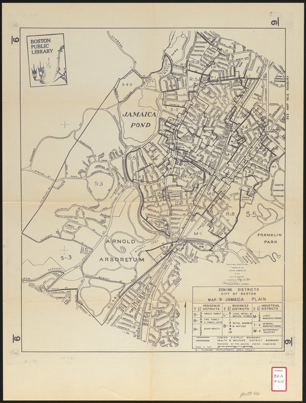
This map, adopted by the Commission 15 August 1962, depicts the following: street and prominent names, residential districts (single family, two-three family, and apartments), business districts (local retail and service stores and retail business and offfice), industrial districts (light manufacturing and general manufacturing), health and welfare district boundary, and planned development areas (PDA).
- Cartographer:
- Boston Zoning Commission
- Date:
-
August 15, 1962
- Format:
-
Maps/Atlases
- Location:
-
Boston Public Library
Central Library in Copley Square - Collection (local):
-
Boston Public Library Collection
- Subjects:
-
Land use--Massachusetts--Boston--Maps
Zoning--Massachusetts--Boston--Maps
Jamaica Plain (Boston, Mass.)--Maps
- Places:
-
Suffolk (county)BostonJamaica Plain
- Extent:
- 1 map ; 50 x 41 cm
- Terms of Use:
-
No known copyright restrictions.
No known restrictions on use.
- Publisher:
-
Boston :
Boston Zoning Commission
- Scale:
-
Scale approximately 1:9,300
- Language:
-
English
- Catalog Record:
-
http://bpl.bibliocommons.com/item/show/1012645075
- Identifier:
-
06_01_017197
- Call #:
-
BRA/4305
- Barcode:
-
39999066610005


