Toggle navigation
LMEC Home
Exhibitions
Georeferencing
Tools for Teachers
Collections
My Favorites
Sign Up / Log In
Search
Search the map portal
Map Collection
Map Collection
Map Sets
Search
Search
Search for
Search In
All Fields
Creator
Title
Subject
Place
Search All Digital Collections
Advanced Search
8722 Results
My Search
Start Over
More Like
commonwealth:6t053q10n
Remove constraint More Like: commonwealth:6t053q10n
Filter your Search
Place
North and Central America
5,953
United States
4,858
Massachusetts
2,080
Europe
1,396
Suffolk (county)
1,046
Boston
1,019
Canada
456
Asia
438
more
Place
»
Topic
Boston (Mass.)--Maps
586
United States--Maps
282
Real property--Massachusetts--Boston--Maps
175
Massachusetts--Maps
163
Landowners--Massachusetts--Boston--Maps
133
New England--Maps
106
North America--Maps--Early works to 1800
103
Europe--Maps
79
more
Topic
»
Date
Date range begin
–
Date range end
Current results range from
1482
to
2023
View distribution
Creator
United States. Hydrographic Office
595
O.H. Bailey & Co
148
Des Barres, Joseph F. W. (Joseph Frederick Wallet), 1722-1824
126
United States. Post Office Dept
120
Ptolemy, 2nd cent
100
Walling, Henry Francis, 1825-1888
94
Geological Survey (U.S.)
90
Jefferys, Thomas, -1771
85
more
Creator
»
Format
Maps/Atlases
8,662
Manuscripts
218
Prints
56
Books
36
Objects/Artifacts
10
Drawings/Illustrations
8
Posters
5
Georeferenced
Yes
870
No
7,852
Collection
Norman B. Leventhal Map & Education Center Collection
8,699
Boston and New England Maps
2,237
Urban Maps
2,023
Maritime Charts and Atlases
1,083
American Revolutionary War-Era Maps
636
Boston Redevelopment Authority Collection
87
American Antiquarian Society Collection
8
William L. Clements Library Collection
6
more
Collection
»
Available to use
No known restrictions
8,557
Creative Commons license
51
Search Constraints
Sort by relevance
relevance
title
date (asc)
date (desc)
Number of results to display per page
20 per page
10
per page
20
per page
50
per page
100
per page
View results as:
grid view
map view
Search Results
1.
North America, Bay of Fundy, Grand Manan Island and adjacent coast : from surveys by the British Admiralty in 1855, and by the...
2.
A map of the Maine coast from York Harbor to Saco Bay : reminiscent & actual
3.
The north point of Grandmanan Island in the bay Fundy bearing e.n.e distant two leagues ; A view of Campo Bello at the entrance...
4.
The north point of Grandmanan Island in the bay Fundy bearing e.n.e distant two leagues ; A view of Campo Bello at the entrance...
5.
Explorer's map & directory of the New England Coast : New London, Connecticut, to Passamaquoddy Bay, Canada : a comprehensive...
6.
A chart of the coast of Maine
7.
A chart of the North-American coast, for the navigation between Halifax and Philadelphia
8.
North America, Dominion of Canada, Gulf of St. Lawrence, Prince Edward Island and adjacent coasts, from Sea Wolf Island to...
9.
Bangor & Aroostook Railroad and connections : including northern Maine hunting and fishing region
10.
Fishing & hunting resorts of Maine, northern New Hampshire, and part of Canada and the provinces, Rangeley & Moosehead Lakes as...
11.
Lumberman's map of northern Maine
12.
Maine
13.
Maine
14.
Map of Maine for the Maine register
15.
Map of Maine, New Hampshire, and Vermont : compiled from the latest authorities
16.
Map of Maine, New Hampshire and Vermont, from the most authentic sources
17.
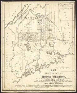
Map of the disputed territory [Maine] : reduced from the original of Messrs. Featherstonehaugh & Mudge, British commissioners
18.
Map of the district of Maine from the latest and best authorities
19.
Map of the district of Maine, Massachusetts : compiled from actual surveys made by order of the General Court and under the...
20.
Map of the seat of war, showing disputed territory, and the boundary lines claimed by Maine & Great Britain and that proposed...
‹ Prev
Next ›
1
2
3
4
5
…
436
437


![Map of the disputed territory [Maine]](https://bpldcassets.blob.core.windows.net/derivatives/images/commonwealth:7h14b025h/image_thumbnail_300.jpg)