Toggle navigation
LMEC Home
Exhibitions
Georeferencing
Tools for Teachers
Collections
My Favorites
Sign Up / Log In
Search
Search the map portal
Map Collection
Map Collection
Map Sets
Search
Search
Search for
Search In
All Fields
Creator
Title
Subject
Place
Search All Digital Collections
Advanced Search
8764 Results
My Search
Start Over
More Like
commonwealth:6t053p90c
Remove constraint More Like: commonwealth:6t053p90c
Filter your Search
Place
North and Central America
5,995
United States
4,909
Massachusetts
2,086
Europe
1,396
Suffolk (county)
1,046
Boston
1,019
Canada
458
Asia
438
more
Place
»
Topic
Boston (Mass.)--Maps
586
United States--Maps
282
Real property--Massachusetts--Boston--Maps
175
Massachusetts--Maps
162
Landowners--Massachusetts--Boston--Maps
133
North America--Maps--Early works to 1800
106
New England--Maps
102
New England--Maps--Early works to 1800
97
more
Topic
»
Date
Date range begin
–
Date range end
Current results range from
1482
to
2023
View distribution
Creator
United States. Hydrographic Office
595
O.H. Bailey & Co
148
Des Barres, Joseph F. W. (Joseph Frederick Wallet), 1722-1824
123
United States. Post Office Dept
120
Ptolemy, 2nd cent
100
Walling, Henry Francis, 1825-1888
94
Jefferys, Thomas, -1771
89
Geological Survey (U.S.)
86
more
Creator
»
Format
Maps/Atlases
8,704
Manuscripts
216
Prints
56
Books
36
Objects/Artifacts
10
Drawings/Illustrations
8
Posters
5
Georeferenced
Yes
874
No
7,890
Collection
Norman B. Leventhal Map & Education Center Collection
8,719
Boston and New England Maps
2,245
Urban Maps
2,023
Maritime Charts and Atlases
1,086
American Revolutionary War-Era Maps
653
Boston Redevelopment Authority Collection
87
Mapping Boston Collection
23
Sidney R. Knafel Map Collection at Phillips Academy
15
more
Collection
»
Available to use
No known restrictions
8,555
Creative Commons license
86
Search Constraints
Sort by relevance
relevance
title
date (asc)
date (desc)
Number of results to display per page
20 per page
10
per page
20
per page
50
per page
100
per page
View results as:
grid view
map view
Search Results
3921.
A map of South Carolina and a part of Georgia : containing the whole sea-coast; all the islands, inlets, rivers, creeks,...
3922.
Map of southeastern portion of United States showing the location of battles in the Civil War 1861-1865
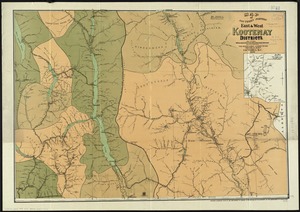
3923.
Map of southern portion East & West Kootenay Districts
3924.
Map of Springfield, Massachusetts
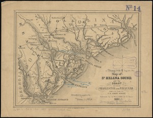
3925.
Map of St. Helena Sound, and the coast between Charleston and Savannah
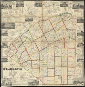
3926.
Map of St. Lawrence Co. New York
3927.
Map of St. Louis city & county : prepared for City Plan Report of The Civic League showing proposed improvements
3928.
Map of St. Paul
3929.
Map of street railways in eastern Massachusetts
3930.
A map of such parts of Georgia and South Carolina as tend to illustrate the progress and operations of the British Army, &c
3931.
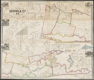
Map of Suffolk Co., L.I., New York : from actual surveys
3932.
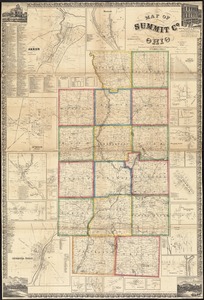
Map of Summit Co., Ohio
3933.
Map of Surf-Side, the property of the Nantucket Surf-Side Company
3934.
Map of Swampscott, Nahant & Saugus
3935.
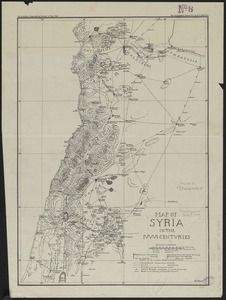
Map of Syria in the IV-V-VI centuries
3936.
Map of Taunton
3937.
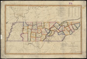
Map of Tennessee
3938.
A map of Terra Firma Peru, Amazone-land, Brasil & the north p[art] of La Plata
3939.
Map of Texas and parts of adjoining territories
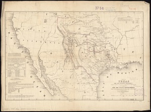
3940.
Map of Texas and the country adjacent
‹ Prev
Next ›
1
2
…
193
194
195
196
197
198
199
200
201
…
438
439


![A map of Terra Firma Peru, Amazone-land, Brasil & the north p[art] of La Plata](https://bpldcassets.blob.core.windows.net/derivatives/images/commonwealth:xg94j123n/image_thumbnail_300.jpg)