Map of St. Paul
Item Information
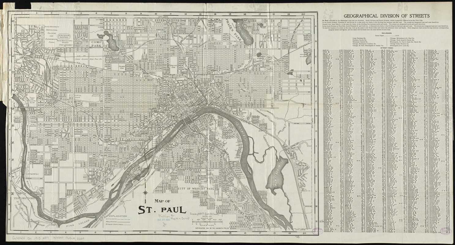
- Title:
- Map of St. Paul
- Title (alt.):
-
Kirk's new map of Saint Paul
- Creator:
- Kirk, Fred W.
- Name on Item:
-
compiled & drawn by Fred W. Kirk.
- Date:
-
[ca. 1915]
- Format:
-
Maps/Atlases
- Location:
-
Boston Public Library
Norman B. Leventhal Map & Education Center - Collection (local):
-
Norman B. Leventhal Map & Education Center Collection
- Subjects:
-
Saint Paul (Minn.)--Maps
- Places:
-
MinnesotaRamsey (county)St. Paul
- Extent:
- 1 map ; 42 x 59 cm., on sheet 46 x 87 cm., folded in cover 18 x 11 cm.
- Terms of Use:
-
No known copyright restrictions.
No known restrictions on use.
- Publisher:
-
[Saint Paul, Minn.] :
H.M. Smyth Ptg. Co.
- Scale:
-
Scale [ca. 1:28,000]
- Language:
-
English
- Notes:
-
Includes street index.
- Identifier:
-
06_01_011225
- Call #:
-
G4144.S4 1915 .K57
- Barcode:
-
39999065682229


