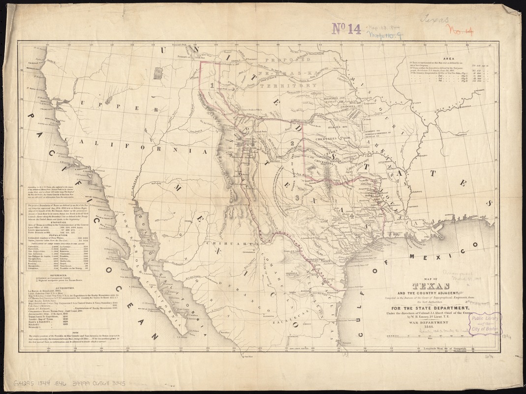
Map of Texas and the country adjacent
Item Information
- Title:
- Map of Texas and the country adjacent
- Creator:
- Emory, William H. (William Hemsley), 1811-1887
- Name on Item:
-
compiled in the Bureau of the Corps of Topographical Engeneers [sic], from the best authorities, for the State Department, under the direction of Col. J.J. Abert, Chief of the Corps, by W.H. Emory, 1st Lieut. T.E.
- Date:
-
1844
- Format:
-
Maps/Atlases
- Location:
-
Boston Public Library
Norman B. Leventhal Map & Education Center - Collection (local):
-
Norman B. Leventhal Map & Education Center Collection
- Subjects:
-
Indians of North America--Oklahoma--Maps
Texas--Maps
Southwestern States--Maps
- Places:
-
Southwest (area)
Oklahoma
Texas
- Extent:
- 1 map : hand color, mounted on linen ; 37 x 55 cm
- Terms of Use:
-
No known copyright restrictions.
No known restrictions on use.
- Publisher:
-
[Washington?] :
War Dept.
- Scale:
-
Scale [ca. 1:6,500,000]
- Language:
-
English
- Notes:
-
Relief shown by hachures.
Shows Indian tribes and various routes, including "Pike's Route," "Long's Route," "Gregg's Route in 1840," and "Road to Santa Fé laid out in 1825."
Prime meridians: Greenwich and Washington.
Includes text, statistics, and list of population.
- Identifier:
-
06_01_011321
- Call #:
-
G4295 1844 .E46
- Barcode:
-
39999065683045


