Toggle navigation
LMEC Home
Exhibitions
Georeferencing
Tools for Teachers
Collections
My Favorites
Sign Up / Log In
Search
Search the map portal
Map Collection
Map Collection
Map Sets
Search
Search
Search for
Search In
All Fields
Creator
Title
Subject
Place
Search All Digital Collections
Advanced Search
8764 Results
My Search
Start Over
More Like
commonwealth:6t053p90c
Remove constraint More Like: commonwealth:6t053p90c
Filter your Search
Place
North and Central America
5,995
United States
4,909
Massachusetts
2,086
Europe
1,396
Suffolk (county)
1,046
Boston
1,019
Canada
458
Asia
438
more
Place
»
Topic
Boston (Mass.)--Maps
586
United States--Maps
282
Real property--Massachusetts--Boston--Maps
175
Massachusetts--Maps
162
Landowners--Massachusetts--Boston--Maps
133
North America--Maps--Early works to 1800
106
New England--Maps
102
New England--Maps--Early works to 1800
97
more
Topic
»
Date
Date range begin
–
Date range end
Current results range from
1482
to
2023
View distribution
Creator
United States. Hydrographic Office
595
O.H. Bailey & Co
148
Des Barres, Joseph F. W. (Joseph Frederick Wallet), 1722-1824
123
United States. Post Office Dept
120
Ptolemy, 2nd cent
100
Walling, Henry Francis, 1825-1888
94
Jefferys, Thomas, -1771
89
Geological Survey (U.S.)
86
more
Creator
»
Format
Maps/Atlases
8,704
Manuscripts
216
Prints
56
Books
36
Objects/Artifacts
10
Drawings/Illustrations
8
Posters
5
Georeferenced
Yes
874
No
7,890
Collection
Norman B. Leventhal Map & Education Center Collection
8,719
Boston and New England Maps
2,245
Urban Maps
2,023
Maritime Charts and Atlases
1,086
American Revolutionary War-Era Maps
653
Boston Redevelopment Authority Collection
87
Mapping Boston Collection
23
Sidney R. Knafel Map Collection at Phillips Academy
15
more
Collection
»
Available to use
No known restrictions
8,555
Creative Commons license
86
Search Constraints
Sort by relevance
relevance
title
date (asc)
date (desc)
Number of results to display per page
20 per page
10
per page
20
per page
50
per page
100
per page
View results as:
grid view
map view
Search Results
3841.
Map of northern Luzon
3842.
Map of northern Luzon, showing a portion of the field of operations of the 8th Army Corps, Major General Elwell S. Otis commanding
3843.
Map of northern part of New York City
3844.
Map of Nova Scotia, or Acadia : with the islands of Cape Breton and St. John's, from actual surveys
3845.
Map of Oklahoma Territory
3846.
Map of Ontario and Quebec showing location and capacity of flour mills and elevators
3847.
Map of Ontario County, New York : from actual surveys
3848.
Map of Oregon and upper California, from the surveys of John Charles Frémont and other authorities
3849.
Map of Oshkosh
3850.
Map of Palestine and all Bible lands, containing the ancient and modern names of all known places, a table of seasons, weather,...
3851.
Map of part of Boston, Mass
3852.
Map of part of Cambridge, Mass
3853.
A map of part of Rhode Island shewing the positions of the American and British armies at the Siege of Newport, and the...
3854.
Map of part of the Dominion of Canada, shewing location of some of the principal products, also railway & water routes
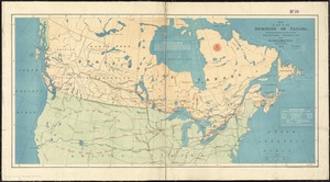
3855.
A map of part of the Isthmus of Darien : shewing the communication with Panama, from Portobello & Chagre both by land, and by...
3856.
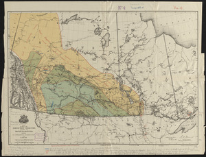
Map of part of the North West Territory, including the province of Manitoba : shewing an approximate classification of the lands
3857.
A map of part of the N:W: Territory of the United States : compiled from actual surveys, and the best information
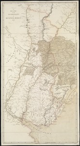
3858.
A map of part of the Viceroyalty of Buenos Ayres 1806
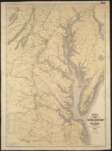
3859.
Map of part of Virginia, Maryland and Delaware from the best authorities
3860.
Map of parts of Middlesex & Essex counties, showing the rail road routes between Salem, Lowell, Boston & Methuen
‹ Prev
Next ›
1
2
…
189
190
191
192
193
194
195
196
197
…
438
439