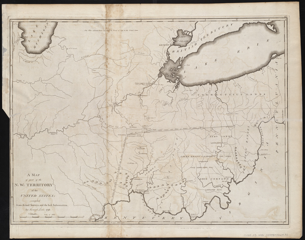
A map of part of the N:W: Territory of the United States : compiled from actual surveys, and the best information
Item Information
- Title:
- A map of part of the N:W: Territory of the United States : compiled from actual surveys, and the best information
- Creator:
- Lewis, Samuel, 1753 or 4-1822
- Cartographer:
- Lewis, Samuel, 1753 or 4-1822
- Engraver:
- Barker, W. (William), active 1795-1803
- Publisher:
- Carey, Mathew, 1760-1839
- Name on Item:
-
by Samuel Lewis ; W. Barker sculp.
- Date:
-
[1800]
- Format:
-
Maps/Atlases
- Location:
-
Boston Public Library
Norman B. Leventhal Map & Education Center - Collection (local):
-
Norman B. Leventhal Map & Education Center Collection
- Subjects:
-
Indiana--Maps
Michigan--Maps
Ohio--Maps
- Places:
-
Indiana
Michigan
Ohio
- Extent:
- 1 map ; 47 x 64 cm
- Terms of Use:
-
No known copyright restrictions.
No known restrictions on use.
- Publisher:
-
[Philadelphia] :
[Mathew Carey]
- Scale:
-
Scale approximately 1:10,800,000
- Language:
-
English
- Notes:
-
Relief shown pictorially.
Prime meridian: Philadelphia.
In upper right: 47.
Map 47 in his Carey's general atlas. Philadelphia : Mathew Carey, 1800.
- Notes (date):
-
This date is inferred.
- Identifier:
-
06_01_004566
- Call #:
-
G1015 .C3 1800x
- Barcode:
-
30000005058242