Toggle navigation
LMEC Home
Exhibitions
Georeferencing
Tools for Teachers
Collections
My Favorites
Sign Up / Log In
Search
Search the map portal
Map Collection
Map Collection
Map Sets
Search
Search
Search for
Search In
All Fields
Creator
Title
Subject
Place
Search All Digital Collections
Advanced Search
8549 Results
My Search
Start Over
More Like
commonwealth:3f463956g
Remove constraint More Like: commonwealth:3f463956g
Filter your Search
Place
North and Central America
5,844
United States
4,768
Massachusetts
2,052
Europe
1,359
Suffolk (county)
1,034
Boston
1,007
Canada
448
Asia
422
more
Place
»
Topic
Boston (Mass.)--Maps
577
United States--Maps
273
Real property--Massachusetts--Boston--Maps
174
Massachusetts--Maps
160
Landowners--Massachusetts--Boston--Maps
132
North America--Maps--Early works to 1800
103
New England--Maps
99
Europe--Maps
78
more
Topic
»
Date
Date range begin
–
Date range end
Current results range from
1482
to
2023
View distribution
Creator
United States. Hydrographic Office
594
O.H. Bailey & Co
148
Des Barres, Joseph F. W. (Joseph Frederick Wallet), 1722-1824
122
United States. Post Office Dept
120
Ptolemy, 2nd cent
100
Walling, Henry Francis, 1825-1888
94
Geological Survey (U.S.)
86
Jefferys, Thomas, -1771
85
more
Creator
»
Format
Maps/Atlases
8,490
Manuscripts
215
Prints
56
Books
36
Objects/Artifacts
10
Drawings/Illustrations
8
Posters
4
Georeferenced
Yes
869
No
7,680
Collection
Norman B. Leventhal Map & Education Center Collection
8,549
Boston and New England Maps
2,203
Urban Maps
1,936
Maritime Charts and Atlases
1,080
American Revolutionary War-Era Maps
615
Boston Redevelopment Authority Collection
87
Available to use
No known restrictions
8,408
Creative Commons license
46
Search Constraints
Sort by relevance
relevance
title
date (asc)
date (desc)
Number of results to display per page
20 per page
10
per page
20
per page
50
per page
100
per page
View results as:
grid view
map view
Search Results
8381.
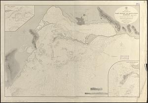
West Indies, Jamaica--south coast, Port Royal and Kingston Harbors : from British surveys to 1874, corrected to 1881
8382.
West Indies, Little Bahama Bank, Whale Cay Channel and Green Turtle Cay anchorage : from a British survey in 1882-3
8383.
West Indies, n. coast of St. Domingo, Manzanillo Bay
8384.
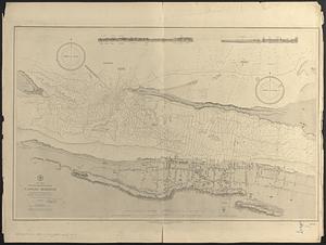
West Indies, New Providence Island, Nassau Harbor : from British surveys in 1841, 1866 and 1881
8385.
West Indies, north coast of Cuba, Bahia Honda : from a Spanish plan corrected to 1883 ; West Indies, north coast of Cuba, Port...
8386.
West Indies, north coast of Cuba, Port Matanzas : from a Spanish survey in 1892
8387.
West Indies, north coast of Cuba, Port Matanzas : from a Spanish survey in 1892
8388.
West Indies, north coast of Cuba, Port Tanamo : from a Spanish plan, corrected to 1883 ; West Indies, north coast of Cuba, Port...
8389.
West Indies, north coast of Santo Domingo, Port Plata
8390.
West Indies, port & anchorages on the north east coast of Cuba : from Spanish government surveys in 1867-8
8391.
West Indies, Port San Juan, north side of Porto Rico : from a Spanish survey in 1868, corrected to 1874
8392.
West Indies, ports and anchorages at the eastern end of Cuba : from Spanish government surveys in 1860-74
8393.
West Indies, ports on the north and west coasts of Haiti : from the most recent surveys
8394.
West Indies, ports on the north coast of Cuba : from Spanish government surveys corrected to 1883
8395.
West Indies, ports on the north coast of Cuba : from Spanish government surveys corrected to 1883
8396.
West Indies, ports on the north coast of Cuba : from Spanish surveys corrected to 1883
8397.
West Indies, ports on the north coast of Cuba : from Spanish surveys corrected to 1883
8398.
West Indies, ports on the north west coast of Haiti : from the most recent surveys
8399.
West Indies, ports on the south and west coasts of Haiti : from the most recent surveys
8400.
West Indies, Roatan Island, Coxen Hole : from an English plan published in 1843 ; West Indies, Roatan Island, Port Royal Harbor...
‹ Prev
Next ›
1
2
…
416
417
418
419
420
421
422
423
424
…
427
428