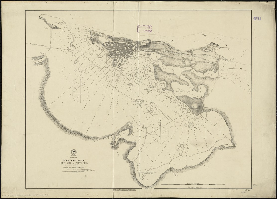
West Indies, Port San Juan, north side of Porto Rico : from a Spanish survey in 1868, corrected to 1874
Item Information
- Title:
- West Indies, Port San Juan, north side of Porto Rico : from a Spanish survey in 1868, corrected to 1874
- Title (alt.):
-
Port San Juan, north side of Porto Rico
- Creator:
- United States. Hydrographic Office
- Name on Item:
-
H. H. Wyman Commo. U. S. N. Hydrographer to the Bureau of Navigation.
- Date:
-
1874
- Format:
-
Maps/Atlases
- Location:
-
Boston Public Library
Norman B. Leventhal Map & Education Center - Collection (local):
-
Norman B. Leventhal Map & Education Center Collection
- Subjects:
-
Harbors--Puerto Rico--San Juan--Maps
Nautical charts--Puerto Rico--San Juan Bay
San Juan (P.R.)--Maps
San Juan Bay (P.R.)--Maps
- Places:
-
San Juan, Bahía de (bay)
- Extent:
- 1 map ; 71 x 89 cm.
- Terms of Use:
-
No known copyright restrictions.
No known restrictions on use.
- Publisher:
-
Washington, D. C :
Hydrographic Office
- Scale:
-
Scale [ca. 1:7,950]
- Language:
-
English
- Notes:
-
Relief shown by hachures. Depth shown by soundings.
- Identifier:
-
06_01_009140
- Call #:
-
G4972.S25P5 1874 .U55x
- Barcode:
-
39999065659169