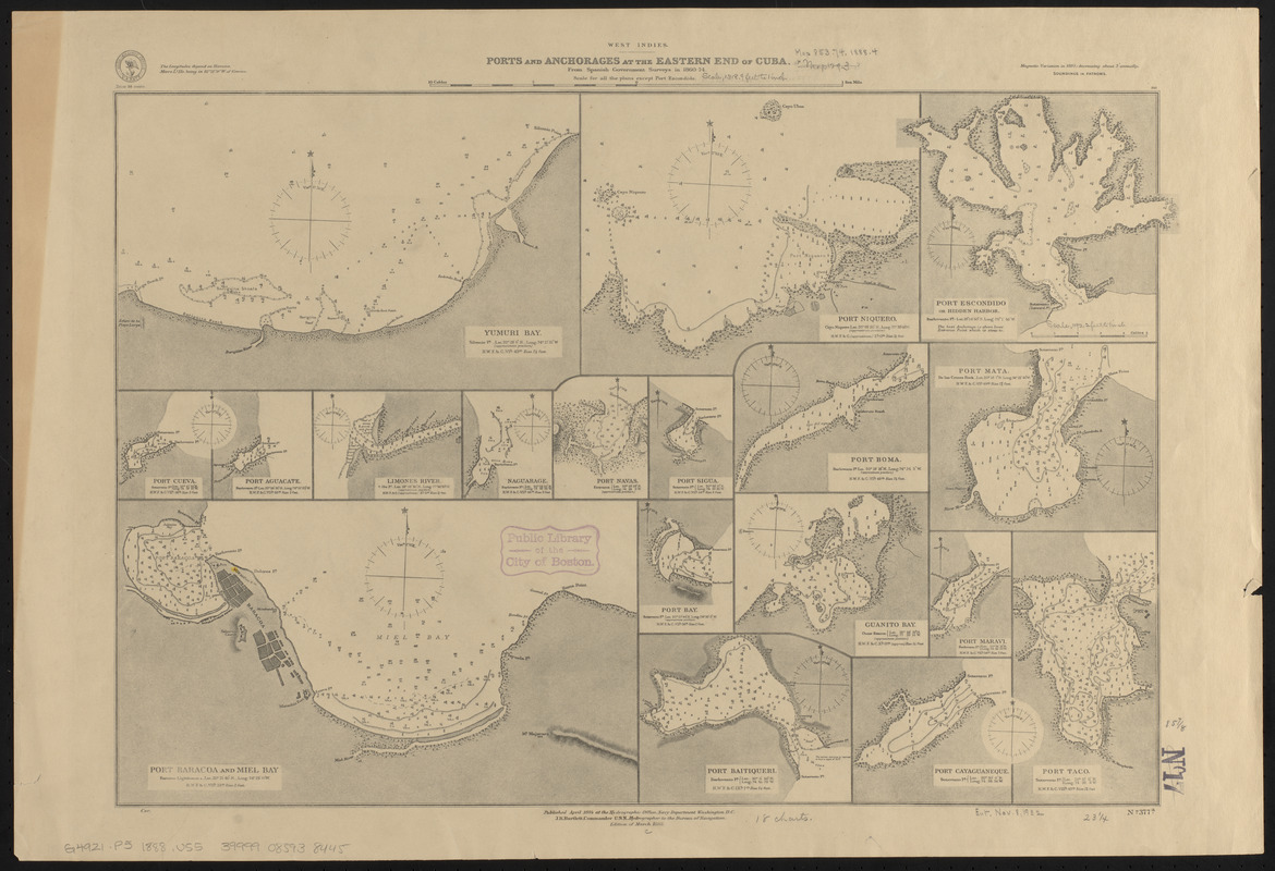
West Indies, ports and anchorages at the eastern end of Cuba : from Spanish government surveys in 1860-74
Item Information
- Title:
- West Indies, ports and anchorages at the eastern end of Cuba : from Spanish government surveys in 1860-74
- Title (alt.):
-
Ports and anchorages at the eastern end of Cuba
- Issuing body:
- United States. Hydrographic Office
- Date:
-
1888
- Format:
-
Maps/Atlases
- Location:
-
Boston Public Library
Norman B. Leventhal Map & Education Center - Collection (local):
-
Norman B. Leventhal Map & Education Center Collection
- Subjects:
-
Bays--Cuba--Maps
Harbors--Cuba--Maps
Nautical charts--Cuba
Cuba--Maps
- Places:
-
Cuba
- Extent:
- 18 maps on 1 sheet ; 41 x 59 cm
- Terms of Use:
-
No known copyright restrictions.
No known restrictions on use.
- Publisher:
-
Washington, D.C. :
Hydrographic Office
- Edition:
- Edition of March 1888
- Scale:
-
Scales differ
- Language:
-
English
- Table of Contents:
-
Yumuri Bay
Port Niquero
Port Escondido or Hidden Harbor
Port Cueva
Port Aguacate
Limones River
Naguarage
Port Navas
Port Sigua
Port Boma
Port Mata
Port Baracoa and Miel Bay
Port Bay
Guanito Bay
Port Baitiqueri
Port Maravi
Port Cayaguaneque
Port Taco.
- Notes:
-
Relief shown by hachures and spot heights. Depths shown by soundings and isolines.
- Identifier:
-
06_01_015653
- Call #:
-
G9096.P5 svar .U55
- Barcode:
-
39999085938445