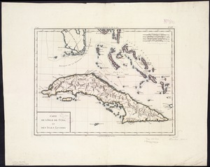
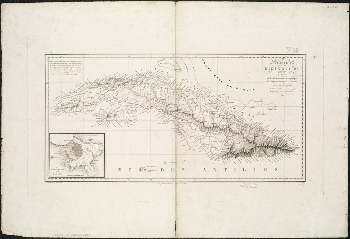
Carte de l'ile de Cuba
Item Information
- Title:
- Carte de l'ile de Cuba
- Creator:
- Lapie, (Pierre), M, 1779-1850
- Name on Item:
-
rédigée sur les observations astronomiques des navigateurs espagnols et sur celles de Mr. de Humboldt ; par P. Lapie.
- Date:
-
1820
- Format:
-
Maps/Atlases
- Location:
-
Boston Public Library
Norman B. Leventhal Map & Education Center - Collection (local):
-
Norman B. Leventhal Map & Education Center Collection
- Subjects:
-
Cuba--Maps
- Places:
-
Cuba
- Extent:
- 1 map ; 30 x 63 cm.
- Terms of Use:
-
No known copyright restrictions.
No known restrictions on use.
- Publisher:
-
Paris :
[s.n.]
- Scale:
-
Scale not given.
- Language:
-
French
- Notes:
-
Relief shown by hachures. Depths shown by soundings.
Inset: Plan du port et de la ville de la Havane.
Gravée par Flahaut ; ecrit par Lallemand.
Cataloging, conservation, and digitization made possible in part by The National Endowment for the Humanities: Exploring the human endeavor.
- Identifier:
-
06_01_006346
- Call #:
-
G4920 1820 .L36
- Barcode:
-
39999059024883